

Published Wednesday, November 1, 2023
HIGHLAND FIRE

Incident Summary
Fire Name — A wildfire named the Highland Fire ignited from an unknown source on October 30th around 1237 hours PDT.
Fire Location — It is located on Highland and Aguanga Ranchos Roads in Aguanga (Riverside County), California.
Initial Fire Response –On the day of the fire, October 30th, it was stated by many that it had a dangerous rate of spread.
Fire Conditions Quickly Deteriorate — It jumped Hwy 371 and then began burning in flat and lighter fuels. Images of horses in a corral and flames lapping nearby gave us the chills of wanting to help these poor animals, unable to escape the horrors they are about to face.
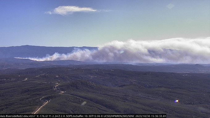
Aviation Assets Deployed — Aviation assets were immediately dispatched on the day of the fire and well into the night. Some of the resources fighting the fire from the skies were said to be Air Attack 12, Lead Plane Bravo 55 along with air tankers 02, 41, and 106 followed by four helicopters.
Photo Credit | Caltrans District 8

Those on the ground included initially eight dozers and 15 additional engines.
Photo Credit | UCSD
Current Status
Fire Behavior — Fire behavior for today has been reported as mild throughout the day.
There has been little to minimal fire growth enabling fire resources to continue with hand and dozer line construction along the fire’s perimeter.
Fire Conditions — The conditions include very steep, access difficulties and rock terrain. Expectations for future spotting have been discussed of to crossover the containment lines but resources also have a contingency plan to address those situations.
Threatened — There are still 2,356 structures directly under threat. All evacuation orders and warnings have been issued and are still in force.
Evacuation Orders — N. of Riverside/San Diego County line. E. of Crosley Truck Trail. S. of Cottonwood School Road. W. of Sorenson Road.
Shelter (People) — Great Oak H.S., 32555 Deer Hollow Way, Temecula, California.
Evacuation Center (Small/large animals) — San Jacinto Animal Campus. 581 S. Grand Avenue, San Jacinto. Need assistance with evacuations? Call 91-358-7387.
Red Cross volunteers have been volunteering and manning the shelters for those who need them. | Photo Credit: ARC

Damage Assessment — 2,487 acres of land with seven structures have been destroyed. Six buildings also have been damaged.
Injuries — One has been reported. It is unknown if it is a firefighter or a civilian at this time.
There is a 20% containment status. Firefighters continue to follow their fire suppression and containment status plans until they reach their 100% goal.
Resources
Resources & Equipment — Currently, there are a total of 1,235 personnel with four helicopters, 137 engines, 11 dozers, 14 water tenders, and four other assigned-type resources.
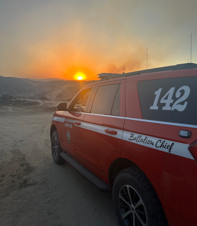
Command — At this time, there is a Unified Command system setup between CAL FIRE Riverside, the Riverside County Sheriff’s Department, and the Riverside County Type 3 All Hazard IMT.
Incident Cooperators — The Incident Cooperators for this wildfire include those with the CA Highway Patrol, CA DOC, CA DOT, American Medical Response, American Red Cross, Caltrans District 8, CA Conservation Corps, CA OES, Red Cross, Riverside County EMD, Riverside County Animal Services, USFS, USDA, BLM, North County Fire Protection District, Bureau of Indian Affairs, Southern CA Edison, San Bernardino County FD, and Anza Electric Co-op.
Closures
Roads — Hwy 79 from Vail Lake to San Diego County line.
Sage Road from Hwy 79 to Wilson Valley Road.
Willson Valley Road from Sage to Hwy 371.
Hwy 371 from Hwy 79 to Wilson Valley Road.
Projected Property and Content Losses — There are unknown costs to property loss, damage and/or contents numbers known.
It is also unknown what the total cost-to-date for fire suppression and containment efforts expenses at the time of this post.
(c) 2023 NW Fire Blog
