
California has been ablaze for the longest time and well before our Fire Season started here in the northwest. Well, as they say in this State, that there really isn’t Fire Season that starts at a specific time but rather it has become year-round which is very bad sign.
Here is a current recap of all the wildfires burning in California. We may have missed a few but we will get them added as quickly as possible.
New! Unnamed Fire – Big Gulch Road and Hwy 1, North of Gualala
New incident as of 8/15/2021 0030 PT. Fire and Law Enforcement on-scene. Source: Mendocino County SO.
ANTELOPE FIRE – Antelope Creek Drainage
Burning 20 miles northeast of McCloud.
Active fire behavior with flanking, torching and spotting.

Evacuation Orders – The Siskiyou County Sheriff’s Office has issued EVACUATION ORDERS for the following communities: Areas between Sharp Mountain, Wild Horse to Garner Butte, Long Prairie Road west to Three Sisters, Three Sisters south to Garner Butte Tarmac area, Mount Hebron, Shasta Wood, Duck Lake, Round Valley area south of Red Rock Road, including Long Prairie Road, Robison Road, Old State Highway.
Evacuation Warnings – The Siskiyou County Sheriff’s Office has issued EVACUATION WARNINGS for the following communities: East of Garner Mountain, South of Red Rock Road, West of Medicine Lake area, including Red Cap Mountain, North of Harris Springs Road, Tennant, Bray, Antelope Sink areas, Red Rock Road, Medicine Lake, Payne Springs and Blanche Lake. https://arcg.is/1nnHKm0
Start 8/1/2021 at 1030 PT. Lightning-caused.
USFS. IC SW Area IMT4’s Carl Schwope. 780 total personnel.
51,482 acres. 25% contained. 17 structures lost. $11.4M CTD.
DIXIE FIRE – 15 miles NE of Paradise
>> Community Meeting – 8/15/2021 @ 1500 PT. Old Station, 13385 CA-89. Old Station, CA 96071 >>
To update the community on the latest information regarding the Dixie Fire West Zone. The meeting is open to the public to attend in-person. For those attending the meeting, social distancing is encouraged to limit the spread of COVID-19. – CAL FIRE

Photo Description: A helicopter drops water onto the ground below near the Town of Greenville.
Started 7/13/2021. Cause unknown. Burning in Feather River Canyon near the Cresta Powerhouse and Lake Almanor. About 15 miles NE of Paradise.
Unified Command: CAL FIRE IMT3, CAIIMT4, NPS and BLM. 6,550 total personnel with 20 copters, 570 engines, 198 dozers, 173 water tenders, 91 crews.
552,589 acres. 31% contained. Timber litter/understory, timber (grass and understory) and brush. Active fire behavior with uphill runs, group torching and short-range spotting.
1,120 structures destroyed. 74 structures damaged.
Active fire behavior with uphill runs, group torching and short-range spotting.
$234M Cost-to-date.
Donations to:
- Plumas Bank- Donations can be made at any branch or mailed to PCIRC at PO Box 3005, Quincy, CA 95971
- LDS/Mormon Church- 55 Bellamy Ln, Quincy, CA (Aug 6-9 10am-6pm)
- Red Cross: https://www.redcross.org/local/california/gold-country.html
Damage Assessment Maps: Dixie Fire Structure Status Map (CAL FIRE)
https://tinyurl.com/2m9en9t4
Wildlife Rescue:
- Response for injured wildlife: 1-800-942-6459
- Gold Country Wildlife Rescue: 1-530-885-0862
Plumas County
Recovery Information: https://tinyurl.com/c8c8s5rd
Resources: Public traveling in or near evacuated areas should follow egress route directions identified in the evacuation notifications. Directions provided by mobile devices and GPS units could lead drivers into hazardous areas. Motorists are encouraged to call 1-800-427-7623 for highway information as roadway conditions remain dynamic.
- Website: https://www.plumascounty.us/
- Sheriff Website: https://plumascounty.us/587/Sheriff-Coroner
- Sheriff Facebook: https://www.facebook.com/plumascountysheriff
- Plumas National Forest: https://www.fs.usda.gov/plumas
Evacuation Orders: GO NOW.
- Rush Creek
- Silver Lake (west of Meadow Valley)
- Caribou Rd north to the Humbug Rd and Humboldt Rd intersection
This includes Belden Reservoir and Butte ValleyReservoir - Prattville Butte Reservoir Road and everything west to the Butte/Plumas County line
Humbug Road from the intersection of the Humbug-Humboldt Road west to the Butte County line and everything south of the Humbug Road is under a Mandatory Evacuation Order. - The community of Seneca south to Hwy70 Round Valley Reservoir, Dixie Canyon, IndianFalls
Long Valley (west of Round Valley), Dixie Canyon south to Indian Falls,south of Indian Falls to the Hwy 70/89 Junction. - Northwest of Round Valley Lake to Long Valley Mine and north to Hwy 89 Hwy 70 at Black Hawk Rd, south to Barlow Rd and everything west to SnakeLake
- Everything west of Hwy 89/36 Junction
West along the south side of Hwy 36 to the County Line and south of Hwy 36 to Rock Lake and west to the County Line. - Genesee Valley
ALL OF GENESEE VALLEY, southeast of Taylorsville up the Genesee Rd to just south of Babcock Crossing, Walker Mine Road, north portion of Beckwouth Genesee Road. - Greenville
Community of Greenville, south along Hwy 89 to Stampfli Lane and along North Valley Rd (see map link) - Canyon Dam
- West Shore of Lake Almanor, Prattville
Includes “LAW”, Prattville, Big Meadows, Rocky Point Campground, and the CanyonDam Boat Launch. - East Shore of Lake Almanor
East Shore of Hwy 147 from Canyon Dam north to the Hwy 147 and County Road A-13 intersection. East of Hwy 147 at CO A-13, to little Dyer Mtn, southeast to Dyer Mtn. NEW roadblock at Hwy 147 and Old Haun Road. - North and Eastern parts of Indian Valley
From upper Williams Valley and upper Pecks Valley east to include all portions of North Valley Rd, Diamond Mtn Rd, and North Arm. - From the Hwy 89/Hwy 36 Junction, north along Stover Mtn. Rd to the County Line and west from the Hwy 89/Hwy 36 Junction along the south side of the highway to the County line.
- Chester
From the Hwy36/Hwy89 Junction, east to the causeway, both sides of Hwy 36 through Chester to the Lake Almanor edge and to north to the County Line. - Lake Almanor Peninsula
- Hamilton Branch
- Heart “K” Ranch
Includes Taylor Diggins Mine, north to Engel Mine, east to Lower Lone Rock, south tothe border to Zone 28, west to the Taylor Diggins Mine. - Lone Rock
Includes Moonlight Valley, Engel Mine, Lone Rock Valley, and a portion of Growers Blvd. USFS Rd. 28N32 intersection of Plumas/Lassen line, and east to Diamond Mountain area, south to Lone Rock. - Antelope
Includes the area surrounding Antelope Lake, North to the Plumas/Lassen Line as well as east to the Plumas Lassen Line, including Fruit Growers Blvd USFS Road 28N32, Indian Creek Road, Diamond Mountain Way the area of Thompson Creek and Boulder Creek.
Evacuation Warnings: GET READY.
- High Lakes (Plumas County)
Recreational area of Plumas County east of the Butte/Plumas County Line. - Butterfly Valley, Keddie to Hwy 70 at Black Hawk Rd, SnakeLake
This includes Spanish Creek Campground, Round House Rd, Old Highway
(WEST). - East side of Keddie, Round House Road and Old Hwy (WEST) Hwy 70 at Black Hawk Rd, south to Barlow Rd and everything west to Snake Lake
- Mt. Hough, from north of Quincy to south of Arlington Road
- Oakland Camp
- Crescent Mills
- Taylorsville
- Plumas/Butte County line east to Twain
Includes both sides of Hwy 70 in the areas of Rock Creek, Storrie. - Tobin, Belden, Caribou Rich Bar, and Twain. DOES NOT INCLUDE RUSH CREEK RD.
Shelters:
- Springs of Hope Church at 59 Bell Ln. in Quincy
- Holy Family Catholic Church 108 Taylor Ave. Portola, CA
Animal Shelters:
- Plumas County Fairgrounds 204 Fairground Road, Quincy
(large animals) - 201 Mill Creek Road, Quincy
(small animals) - Recreation Center 101 Meadowview Lane, Chester
Butte County
Evacuation Warnings: GET SET.
- Butte Meadows: This will include Humboldt Rd at Thatcher Ridge, up to Cherry Hill Campgrounds, north to the Butte/Tehama County lines.
- Jonesville area: The Warning will encompass State Route 32 at the Butte/Tehama County line, east to the area of Cherry Hill Campground, southeast to Snag Lake, southwest to Skyway at Bull Creek, north along Skyway to Humboldt Road.
- Snag Lake area: This will include Humbug Summit Rd at the Butte/Plumas County lines, southwest across Snag Lake to Humbug Summit Rd and Skyway. This warning includes the area surrounding High Lakes Rd near the Carr Mine.
- Lake Philbrook area: This area includes Philbrook Lake south to Browns
Ravine Rd just east of 25N22, east to the Butte/Plumas County lines.
Resources:
- Butte County Website: www.buttecounty.net
- Sheriff Website: www.buttecounty.net/sheriffcoroner
- Sheriff Facebook: https://www.facebook.com/bcsonews
- Sheriff Twitter: @ButteSheriff
- Sheriff’s Call Center: (530) 552-3010
- Evacuation Map: https://tinyurl.com/4nm69873
Lassen County
Travels: Public traveling in or near evacuated areas should follow egress route directions identified in the evacuation notifications. Directions provided by mobile devices and GPS units could lead drivers into hazardous areas.
Evacuations: GO NOW.
- Clear Creek, Westwood, and Pine Town area south of Hwy 36 from the Lassen County line east to Moonlight Ranch Rd.
- Lassen National Forest south of Hwy 36 to the Lassen County line including Hamilton Mtn., Coyote Peak, and Indicator Peak.
- Walker Lake area south of Moonlight Rd.
- Area east of Mtn. Meadows Reservoir and south of Hwy 36 to Coppervale.
- South of Hwy 44 from the County line east to McCoy Flat and south to Hwy 36 including Silver Lake, Juniper Lake, and the Caribou Wilderness Area.
- North of Hwy 36 east of A21.
Resources:
- Lassen County Damage Inspection Map: https://arcg.is/0GvCeX
- Lassen County Web site: http://www.co.lassen.ca.us
- Sheriff Website: https://tinyurl.com/sy9frpx6
- Sheriff Facebook: https://www.facebook.com/LassenSheriff
- Lassen National Forest: https://www.fs.usda.gov/lassen
Shelter:
Lassen Community College at 478-200 CA-139 Susanville.
Tehama County
Travels: Public traveling in or near evacuated areas should follow egress route directions identified in the evacuation notifications. Directions provided by mobile devices and GPS units could lead drivers into hazardous areas.
Evacuations: GO NOW.
- TEH- B17 and C17: Evacuation Order for the area of Childs Meadows/Highlands Resort. This will include subzones 228 and 227 Area of Mill Creek, south of Lassen Volcanic Park
- TEH-1 (D18, D19, E18, E19): Evacuation Order for the St. Bernard’s Lodge and Elam-Carter Creek areas.
- TEH-1 (D17): Evacuation Order for the Wilson Creek, Slate Creek, and Area of Mill Creek, south of Lassen Volcanic Park
- TEH- C18: Evacuation Order for the area of Wilson Lake.
- TEH-C19: Evacuation Order for the area to the east of Wilson Lake, to the Tehama/Plumas County line.
Evacuation Warnings: GET SET.
- TEH- C16: Evacuation Warning for the area of Fire Mountain Lodge. This will include subzones 221, 222, 223, 224,225, 226, 228.
- Zone B16: Evacuation Warning for the area north of Mineral
- Note: The town of Mineral is still under an Evacuation Warning.
- T Zone 1: Evacuation Warning to include the area of Colby Creek. The order will begin at the Butte and Tehama County line, west along the Tehama County Line to the intersection with SR32, north along the SR32 corridor to the intersection with SR36, from the intersection with SR32 and SR36, east along SR36 to the intersection with Plumas and Tehama County Line.
Animal Evacuation Shelter:
- Tehama County Complex 1830 Walnut Street, Red Bluff
(large and small animals)
$234M CTD.
GLEN FIRE – Northwest of Dobbins.
Burning on Willow Glen Road and Meadow Lane, northwest of Dobbins in Yuba County. Started 8/11/2021, from an unknown cause. CAL FIRE – Nevada-Yuba-Placer Unit.
10 structures destroyed. All evacuation orders have been lifted.
184 acres. 60% contained. 150 personnel. 10 engines, 1 dozer, 3 water tenders and 2 crews remain. They are in mop-up stage.
MCCASH FIRE – Ten Bear Mountain, McCash Creek.
Burning 14 miles northeast of Somes Bar.
Active fire behavior with flanking, back and single-tree torching.

Started 7/3/2021. Lightning-caused.
2,287 acres. 1% contained. Timber, brush and tall grass.
Passing storms on Friday afternoon brought wind and no rain over the fire area but did allow firefighters to conduct backfiring operations in the mid morning time.
This occurred in the Marble Mountain Wilderness moving north and west towards Cub Creek and the 2017 Ukonom Fire burn scar.
359 personnel. IC: Dave Gesser. USFS- Six Rivers National Forest.
$2.6M CTD.
MCFARLAND FIRE – McFarland Ridge, south of Hwy 36
USFS. Shasta-Trinity National Forest. 4 miles southeast of Wildwood.
Active fire behavior with uphill runs, group torching and long-range spotting.

Started 7/29/2021. 1845 hours PT. Lightning-caused. Burning south of Wildwood.
IC Chris Fogle, CIIMT11. 644 total personnel.
42,924 acres. 68% contained. Timber, chaparral, closed timber litter and live/dead fuel moisture are historically low.
11 injuries. 1 structure damaged. None destroyed. 18 crews, 14 dozers, 7 copters and 22 engines.
$17.8M CTD.
MONUMENT FIRE – Del Loma, near Monument Peak
>> Community Meeting >> Sunday, August 15, 2021 @ 2000 hours via Facebook Live (Virtual).
https://fb.me/e/1FBYd81td and Zoom Public Meeting August 15 Meeting ID: 161 082 0265
Please submit your questions prior to the meeting by email: 2021.monument.firenet.gov.

Evacuation Orders: Junction City, Red Hill, Canyon Creek, Coopers Bar, Big Bar, Del Loma, Big Flat, Helena, Cedar Flat, and Burnt Ranch For detailed evacuation information, visit Trinity County Office Sheriff Facebook: Trinity County Sheriff’s Office | Facebook
Evacuation Centers: American Red Cross Shelters Shasta College, 1555 Old Oregon Trail, Building 1900, Redding CA Trinity Valley Elementary School, 730 California 96, Willow Creek, CA 95573
Road Closures: State Highway 299 is closed from 1.7 miles east of Hawkins Bar at Ammom Road. To Sky Ranch Road in Junction City. Monitor Caltrans’s District 2 website (https://dot.ca.gov/caltrans-near-me/district-2)
Animal Evacuations/Shelters: (Domestic animals) Trinity County Animal Shelter, 563 Mountain View St, Weaverville, CA (530- 623-1370) or (Domestic + Large Animals) Hoopa Rodeo Grounds on Pine Creek Rd, Willow Creek, CA.
Property Damage Assessment: Damage assessment teams have confirmed 32 structures have been destroyed 1 with damage. For questions or information regarding the status of your property, call Trinity County Office of Emergency Services (OES) at 530-623-1116.
Forest Closures: Effective August 7, 2021 through October 31, 2021, the Shasta-Trinity Forest has issued Forest Order No. 14-21-21 Monument Fire Closure. Information on the forest order can be found on the Shasta-Trinity National Forest website. Shasta-Trinity NF
Start 7/30/2021 1800 hours. Lightning-caused.
USFS. Shasta-Trinity NF. IC. CAIIMT5’s Mueller. Total 847 personnel. 11 h and crews, 69 engines, 7 copters, 13 dozers, 5 water tenders and 6 masticators.
80,320 acres. 5% contained. Burning in mostly converted brush, heavy dead and down components are dominant in a lot of area.
Cooperators: Trinity Co SO, CAL FIRE, USFS, HME.
35 structures destroyed. $13.5M CTD.
RIVER COMPLEX – Salmon/Scott Ranger District
(3) fires are burning in this Complex, about 9 miles southwest of Etna.
Active fire behavior with single-tree torching, running and backing.

Started 7/30/2021 0700 hours from lightning.
Burning on the Salmon/Scott Ranger District, Klamath National Forest and Trinity River Management unit and Shasta-Trinity National Forest lands. IC: Steve Watkins, David Cooper (CA IMT 14 Deputy).
39,350 acres. 10% contained. Timber and brush. 653 personnel.
$9.3M CTD.
TAMARACK FIRE – 16 miles S of Gardenerville, NV

Lightning-caused. Started 7/4/2021 at 1600 hours PT.
IC: Scott Stephenson, IC and Tom Raw, Deputy IC. 347 personnel. USFS – Humboldt-Toiyabe National Forest.
68,637 acres. 82% contained. Timber, chaparral and timber. Fire behavior is minimal, creeping and smoldering.
CALIFORNIA RESOURCES
Property Owners. Property owners impacted by recent California fires may be eligible for immediate property tax relief. Please visit #CABOE‘s Disaster Relief webpage at https://boe.ca.gov/proptaxes/disaster-relief.htm… for additional information.https://www.boe.ca.gov/proptaxes/disaster-relief.htm
Sources: CAL FIRE, NIFC, Inciweb,
California News on Social Media
“Smoke from (CA) wiildfires really affecting air quality today.” – Social media user.
“DIXIE FIRE, is the single largest wildfire in CA Fire record books and in the U.S.” – Social media user.
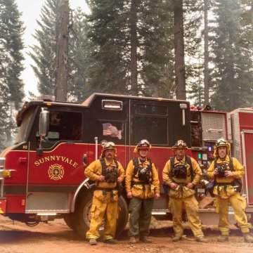
“Sunnyvale Engine 41 has been deployed to the #DixieFire as part of Strike Team 2307A since 8/4.” – Sunnyvale DPS.
“Residents in Northern California are fleeing their homes as destructive and deadly fires tear through their communities. We’ve set up a designated hub with verified fundraisers to assist families as they rebuild and recover.” – Go Fund Me
“We always see smoke in Las Vegas from the California fires; it has never reduced visibility to under 1/4 mile before.” – Social media user.
“Been driving for hours in what again looks like hell on earth.” – CA Driver.
“Thanks to the Canada, Washington, and California fires, my weather forecast for the past month has been “smoke”– A funny poster.
“U cant see the mountains in Denver.”
“A tad bit Smokey in sin city this morning …. Can’t even see much of the strip.” (8/7/2021)
“Damn these California fires getting my eyes all irritated.” (8/11/2021)
“It’s so sad that I can’t even see the sky.” (8/6/2021)
“Santa Cruz CZU lightning fire survivors struggle to rebuild.” (8/15/2021)
“When wildfires erupt in the west, their impacts can be felt far and wide.” (8/15/2021)
“I’m in Texas and we are getting smoke from the California fires.” (8/15/2021)
“Fires are filled with burnt cars & homes, pvc pipe, vinyl siding & floors, plastics, paints, stain resistant chemicals, etc. It’s what is burning your eyes and throat because it’s toxic.” (8/15/2021)
“Believe it or not there is water out there you just can’t see it because of the smoke.” – Lake user. (8/13/2021)
“The US is expected to declare its first-ever “tier one” #watershortage at Lake Mead on the Colorado River which supplies much of Southern California, which is at 37% capacity, the lowest level since it was first filled in the 1930’s.” Think Tanker. (8/13/2021)
“I am packing a bag. What does one pack to evacuate a forest fire?” (8/15/2021)
