

Lone Rock Fire | Fire Update 2 | July 20, 2024
Photo Credit | OSFM
The LONE ROCK FIRE is located east of Lonerock Road and Lost Valley Road in Lone Rock, Oregon, and was started on July 13, 2024, from an undetermined cause, which is under investigation.
At this moment, this wildfire is just one of 94 burning in the northwest alone (OR and WA) with a total number of 407,989.04 acres. This fire data is according to the State of Oregon Fire Marshal’s wildfire incident dashboard. This is not even coming close to the incidents unfolding across the United States.
COMMUNITY MEETING | SATURDAY, JULY 20, 2024 @ 1800 HOURS PT
Grade School Gym (next to Elementary School) | 392 Main St, Fossil, OR 97830
Live Stream | http://www.facebook.com/pnwteam2
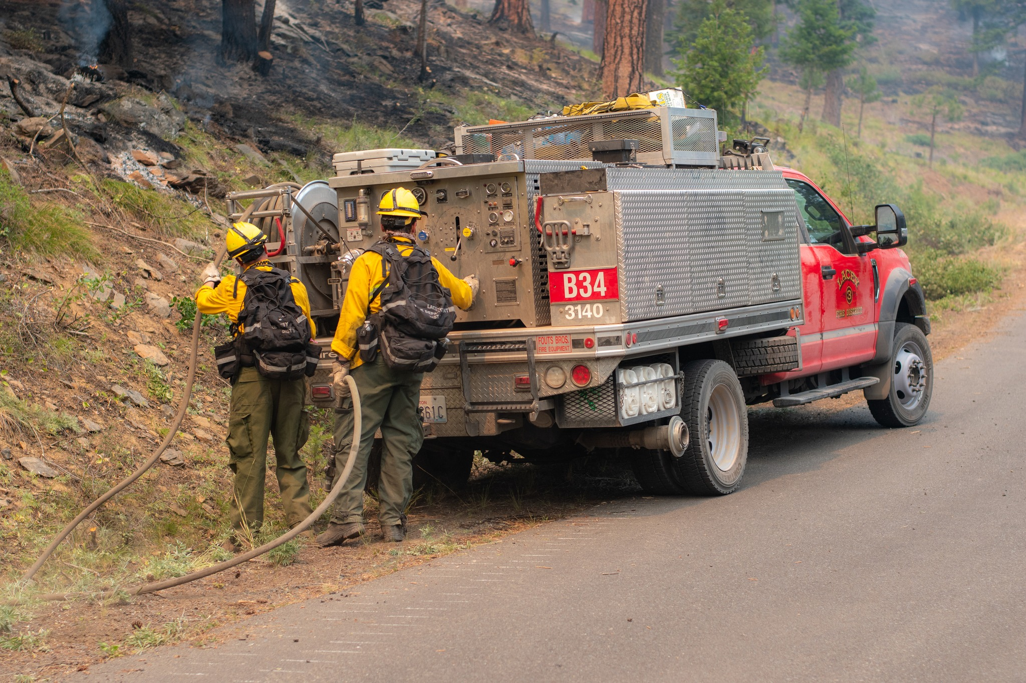
The Northwest Team 2 (NW Team 2) and the Oregon State Fire Marshal (OSFM Red Team) are in Unified Command.
The fire has burned about 83,922 acres of brush, short, and tall grasses and has a 40% containment status. Fire behavior is reported as active with wind-driven runs, group torching, and backing.
Map Credit | OSFM
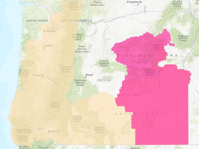
The breakdown on the total acreage is as follows:
- 32,270 | ODF Private Protection
- 46,083 | Unprotected Lands
- 2,105 | BLM
- 3,400 | Forest Service
- 64 | Department of State Lands
The Community of Hardman and numerous structures are being threatened, prompting evacuations, area and road closures.
EVACUATIONS | LEVEL 3 IN EFFECT | JULY 20, 2024
Evacuation Updates | Wheeler County Sheriff’s Office https://www.facebook.com/WheelerCountySheriffsOffice
Evacuation Updates | Morrow County Sheriff’s Office https://www.facebook.com/mcsoheppner
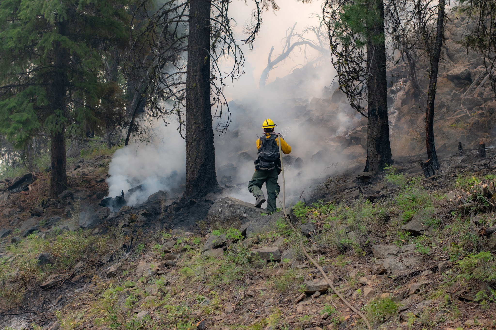
A spot fire occurred on Thursday morning last week and crossed over Highway 25 but was quickly addressed by crews working throughout the day, but when the winds kicked up in the afternoon, the fire behavior increased blowing the fire further south. It would soon spread south into lighter fire fuels from the heavier loads of timber. When this occurs a lot of heavy smoke is visible and creates dangerous conditions for responding air assets and ground resources.
Photo Credit | OSFM
SHELTER | WHEELER HIGH SCHOOL, 600 EAST “B” STREET, FOSSIL, OREGON
Several OSFM Task Forces were called into action and were quickly deployed on the southern front of the fire. Additional TF arrived last night to assist with structure protection. The active fire behavior continued throughout the night into Friday.
During Friday’s update from Fire Officials, it was released that the fire is now displaying extreme fire behavior, as the temps continue to rise and RED FLAG WARNING conditions form in the area.
RED FLAG WARNING IN EFFECT
A Red Flag Warning has been issued by the National Weather Service.
Effective from 7/20/2024 at 1100 hours on Saturday and ends on 7/21/2024, Sunday at 2300 hours PT. This is due to dry, hot, and unstable conditions.
Assigned to this incident are 800 personnel along with 12 crews, 114 engines, two copters, and nine OSFM Task Forces.
Photo Credit | Portland Fire & Rescue

Some of the Incident Cooperators include:
Aircraft Assets
- 10 Tanker Air Carrier – McDonnell Douglas DC-10-30 (Tanker 910)
Federal Resources
- BLM Washington and Oregon
- U.S. Forest Service | Umatilla National Forest
State Resources
- Oregon State Fire Marshal
Task Force 15 | Yamhill County
- Lafayette FD Station 10 | FF/EMT Bert Hanifen and FF/EMR Tyler Frank. They will be on the fire line for seven days.
Task Force | Washington County
- Gaston Rural Fire District (Brush Truck (BR) 1121)
Task Force | Multnomah County
- Portland Fire & Rescue
Task Force | Lane County
- Dexter Rural Fire Protection
County Resources
- Gilliam County | Sheriff’s Office
- Morrow County
- Wheeler County
Contractors
- Lone Wolf Wildfire (E42)
The cost-to-date has reached 7.6 Million Dollars.
(c) 2024 NW Fire Blog
