

Williams Mine Fire
August 11, 2024 | Sunday PM Update
Photo Credit: Inciweb
INCIDENT SUMMARY
The WILLIAMS MINE FIRE was sparked by lightning on August 5, 2024 at noon. It is located about 3.5 miles northwest of Trout Lake in Washington State on the Gifford Pinchot National Forest and its ICP is staffed by the NW Team 13, a CIMT is located 4 miles from Trout Lake. They took command of the incident on August 10th at 0600 hours PT.
INCIDENT COOPERATORS
Incident Cooperators for this Fire Incident:
- WA DNR
- USFS – Gifford Pinchot National Forest
- NWIMT13
- Confederated Tribes and Bands – Yakama Nation
- BLM – US Department of the Interior
CURRENT STATUS
Photo Credit: Inciweb
Fire Behavior
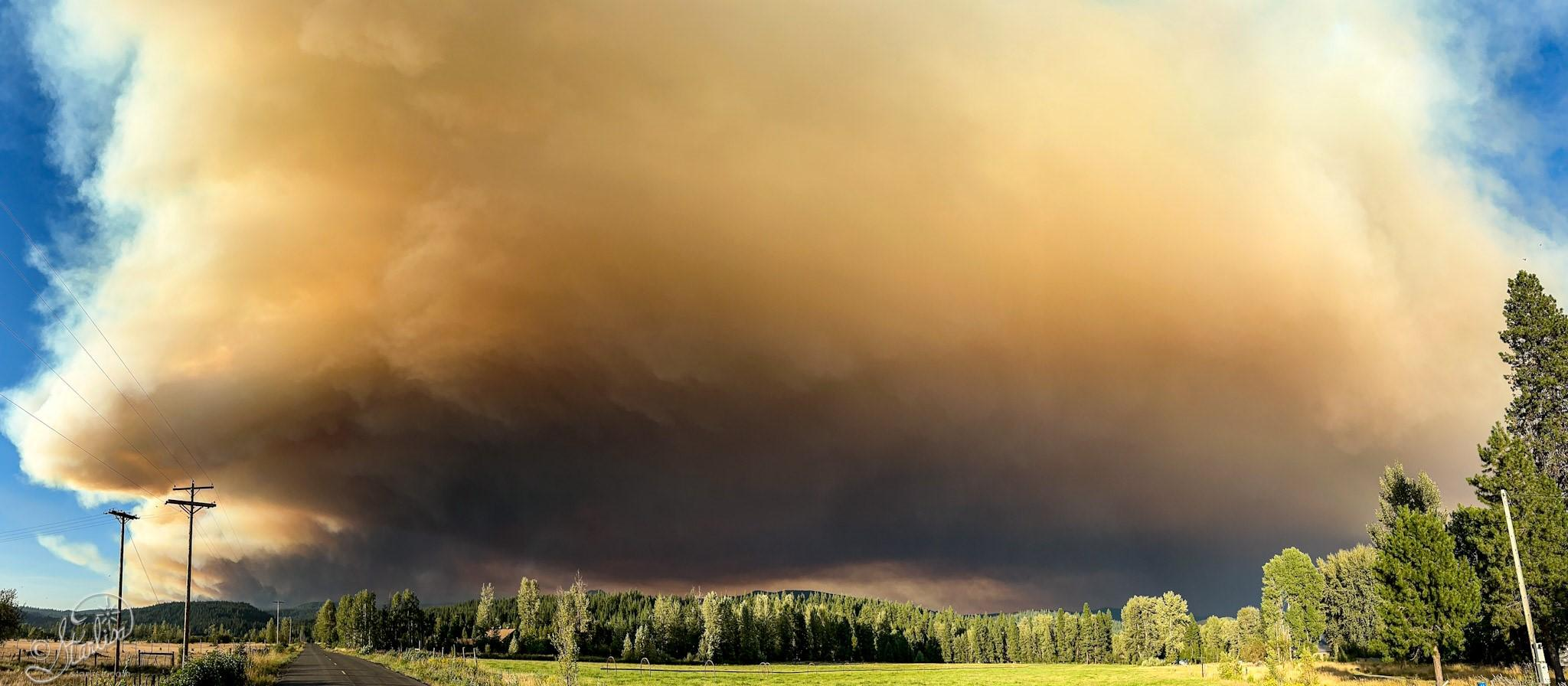
The Fire behavior is active with running, group torching, and spotting. About 100 mixed commercial/residential, 300 homes, and 100 other minor structures are threatened, along with the Town of Trout Lake prompting active evacuation orders in the area.
Size Up
The Fire has burned about 9,346 acres of timber, medium logging slash, and chaparral, which has a 0% containment status.
Trout Lake Emergency Handbook
Downloaded Handbook | https://troutlake.org/emergency-handbook/
FIRE RESOURCES
208 total personnel, 5 engines, 5 dozers, and 3 handcrews.
EVACUATIONS
Level 2s and 3s are in effect by the Klickitat County Sheriff’s Office and the Skamania County Sheriff’s Office.
EVACUATION SHELTER
1455 NW Bruin County Road, White Salmon, Washington.
CLOSURES
Pacific Crest Trail (PCT)
CLOSED: From the PCT’s intersection with FS 23 to Potato Hill and includes the whole area of Mt. Adams Wilderness.
FIRE OPERATIONS
Updated via NW Team 13, a CIMT
General Update
“The Williams Mine Fire is impacting, and adjacent to, lands, that are managed or protected by three land management agencies and one tribal nation. Washington State Department of Natural Resources, United States Forest Service, Bureau of Land Management, and the Confederated Tribes and Bands of the Yakama Nation. Complex Incident Management Team Northwest 13 has been ordered to coordinate management to meet the different missions of each agency.”
Shift Operations
“Night operations were established last night to assess fire growth, prioritize operational engagement, and enhance day-shift firefighting efforts around the southern perimeter of the incident.”
East Flank Ops
“The fire perimeter experienced primarily eastern progression yesterday, and the main eastern flank of the fire is now approximately 2.5 miles away from the Yakama Nation tribal land boundary, near the Pineway Trailhead. Several small spot fires are further east, an estimated 1-2 miles away from the closest point of the Yakama Nation tribal land boundary, around the base of Snipes Mountain.”
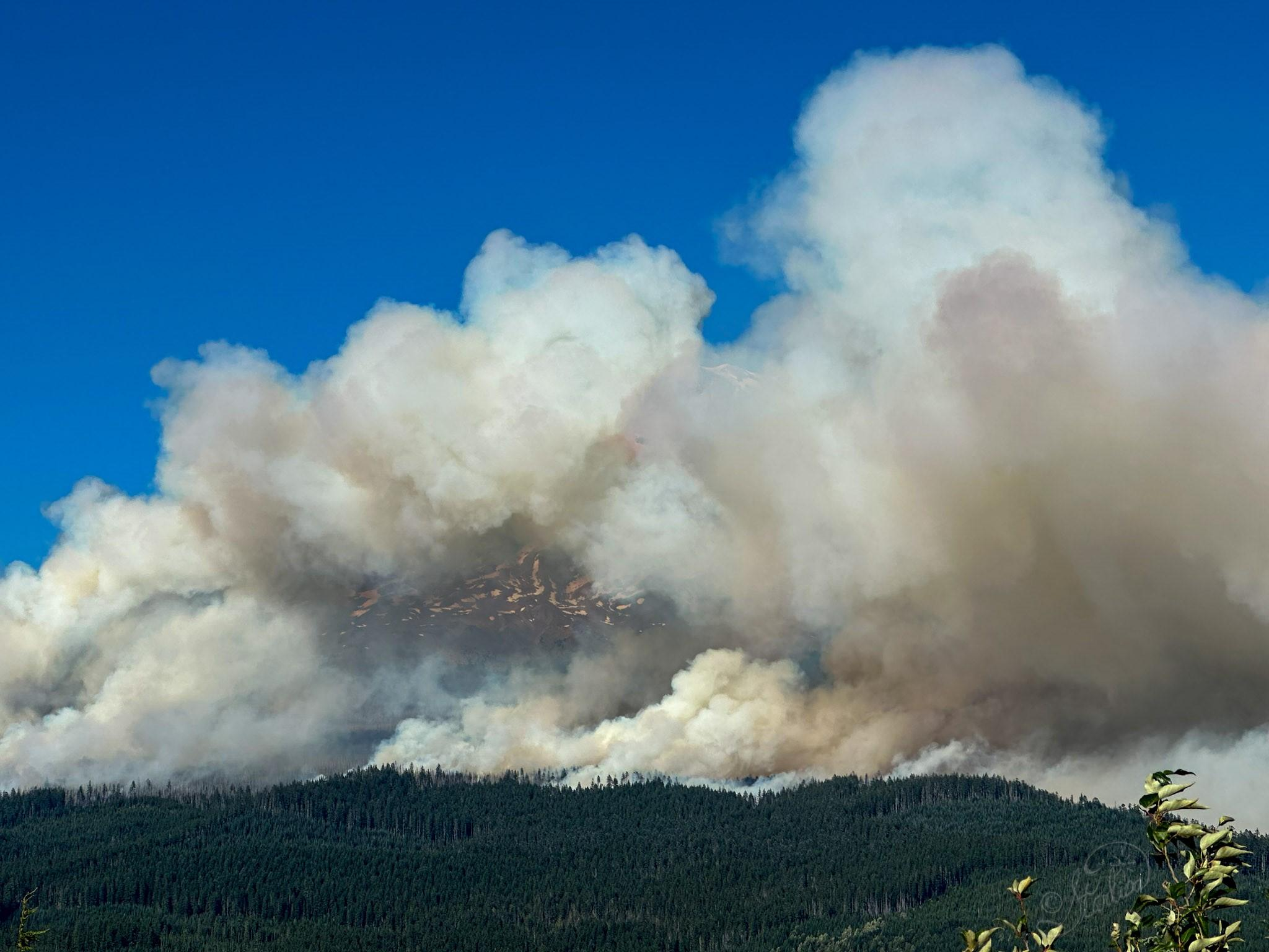
The Williams Mine Fire is currently burning primarily within the 2012 Cascade Creek fire scar, with dense brush and heavy dead/down vegetation. These fuels have led to rapid fire growth and are responsible for heavy smoke and the visible plumes over the fire area.
Yesterday, due to intense winds, spot fires were established approximately one mile ahead of the main body of fire on the eastern flank. The fire is expected to move upslope towards Mt. Adams, through the previous burn scar.”
Heavy Equipment Resources
‘Heavy equipment established an anchor point where firefighters can safely construct fire lines to generate potential containment opportunities and stop forward fire perimeter progression. Masticators are working on roadways to create fire breaks to support primary and contingency containment lines. Firefighters will continue to assess/validate indirect options to the east of the fire to minimize easterly progression, with the predominantly westerly wind pattern.”
Aviation Air Operations
“Two Type 1 helicopters were assigned to the fire yesterday. The Yakama Nation assisted with reconnaissance operations utilizing a Type 3 helicopter. This coordinated effort allows fire managers to develop situational awareness and identify potential control features. Scooper planes will continue to be utilized on the fire and are being filled in the Columbia River.
They currently are operating between Memaloose Island and Lyle, Washington. Fire managers ask residents and visitors to be mindful as they recreate around waterways in proximity to the fire area as an aid in public safety.”
Scooper planes dipping out of Swift Reservoir on Sunday, located south of Mount St. Helens.”
Photo Credit: Gifford Pinchot National Forest (USFS)

HASHTAGS
#WilliamsMineFire #WAwildfires2024
(c) 2024 NW Fire Blog
