

SIT REP 2 | ROAD FIRE | AUGUST 16, 2024
PC: WA DNR

Evacuations In Effect
== LEVEL 2 (GET SET): 2500 block & above Duckabush Rd ==
== LEVEL 1 (GET READY): 1000 blocks up to 2500 blocks of Duckabush Road. ==
Incident Summary
The 2620 ROAD FIRE is burning 10 miles southwest of Quilcene, west of Brinnon, and north of Duckabush Road on Mt. Jupiter in the Olympic National Forest, Washington State.
Cause
The area where the wildfire started was in a logged area. We are not speculating nor guessing what the cause is, as some of you may be doing, as we are only reporting “facts” released by multiple fire agencies and IMTs, PIOs, and “verified” sources.
At this time, no information has yet been released on the “cause” of this wildfire. Once, we have the information – we will let you all know and share it on our platform(s).
NOTE: Do not speculate what the cause is. We will update our page when we find out. Anyone who starts naming off what they think the cause is will have their posts promptly deleted and you, as our follower/poster may be banned for life. We take these things very seriously because we are all about “factual” information. We do the best we can to post the most up-to-date information, but speculation is not what we do. We wait for “verified” sources to release the info first.
Restrictions In Effect
Temporary Flight Restriction, means UAVs/drones, personal or commercial flights on, around, or near the fire. If you fly into the airspace, you could cause a mid-air collision putting those in the air and on the ground lives in danger and other law-breaking activities. Please, just don’t do it.
Incident Cooperators
Resources include those from local, State, and Federal Agencies:
* Olympic National Forest
* WA DNR
* Brinnon Fire Department
* NWICC
* Center Valley Animal Rescue (Quilcene)
* Washington State Patrol (WA State Fire Marshal)
Size Up
The fire has burned about 445 acres according to the WA DNR’s wildcad.net system, which resources were dispatched on August 14, 2024, at 1706 hours PT.
Fire Weather
Per NWICC | Scattered t-storms in E WA today with heavy rain, lightning, and strong winds. Cold front Sat. brings gusts up to 50 mph, raising fire risks in SE OR. PNW fire danger remains high—avoid sparks and report smoke/flames!
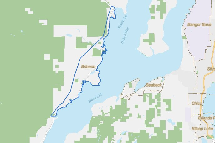
About Brinnon, Washington
Map Credit: U.S. Census Bureau
According to 2022 Census Bureau records, this small town has a population of 907 population which is located in Jefferson County.
There is a total of 436 total households and about 47% of the residents are 65 and above. This looks like a great place to retire.
The community is named in honor of Ewell P Brinnon who in 1860 took a donation land claim at the mouth of the Duckabush River.
It has iconic landmarks: Dosewallips State Park and Black Point Marina. A Boyscout Camp was founded in 1919 and is the oldest camp west of the Mississippi River, called Camp Parsons.
It is located about 61 miles north of Olympia on the east side of the Olympic Peninsula and is on the west side of Hood Canal, as well as on the eastern edge of the Olympic National Forest. US Route 101 runs the total length of the town running south to Olympia and north 59 miles to Port Angeles.
The total land area is 9.61 square miles with a water area of less than one square mile at 0.25. The elevation shows the town at 56 feet above sea level.
Sources For This Post
Sources: US Census Bureau, Wikipedia, NIFC, NWCC, and Brinnon Fire Department.
Hashtags
#2620RoadFire #JupiterFire #WAwildfires2024
(c) 2024 NW Fire Blog
