
WILDFIRES
SNAKE ROAD WILDFIRE (K60127)
Photo Credit | BC Wildfire Service (Snake Road Wildfire below)
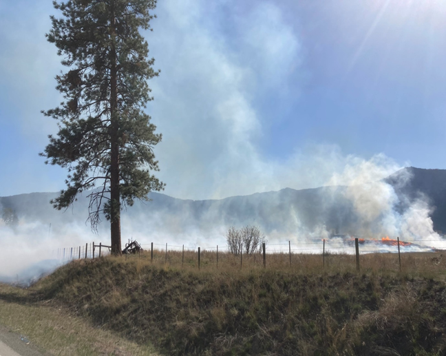
Fire service members were en route to this incident about three hours ago, located about five km (3.1 miles) which is located northwest of the City of Merritt. The size is currently estimated at 20 ha (49.1 acres).
Fire behavior is said to be wind-driven. Incident Cooperators: BC Wildfire and Lower Nicola FD and the Merritt FD. Other resources: One heavy piece of equipment and air tankers.
CLOSED: BCHwy8, due to smoke visible and creating hazardous driving conditions.
PEACE RIVER REGION FIRES
Around 1339 hours PDT, firefighters with the BC Wildfire Service were dispatched to several different incidents (unknown if fire-related) in the Peace River Region, including the Fire (G70124), which was located just north of Hwy 29 and Moberly Lake. It was approximately 50 ha or 143.5 acres.
BE IN THE KNOW
Report a Wildfire:
- Phone: 800-663-5555 toll free or *5555 (cell phone)
- Website: http://www.bcwildfire.ca/prevention/reporting.htm
Evacuation Orders (when in effect)
- Website: http://ww.emergencyinfobc.gov.bc.ca/?
Traffic Reports
- Twitter: @DriveBC for road closures and traffic alerts
© 2023 NW Fire Blog
