

Sit Rep 1 | Tuesday | January 7, 2025 | 2240 PT
Photo Credit | CAL FIRE CZU
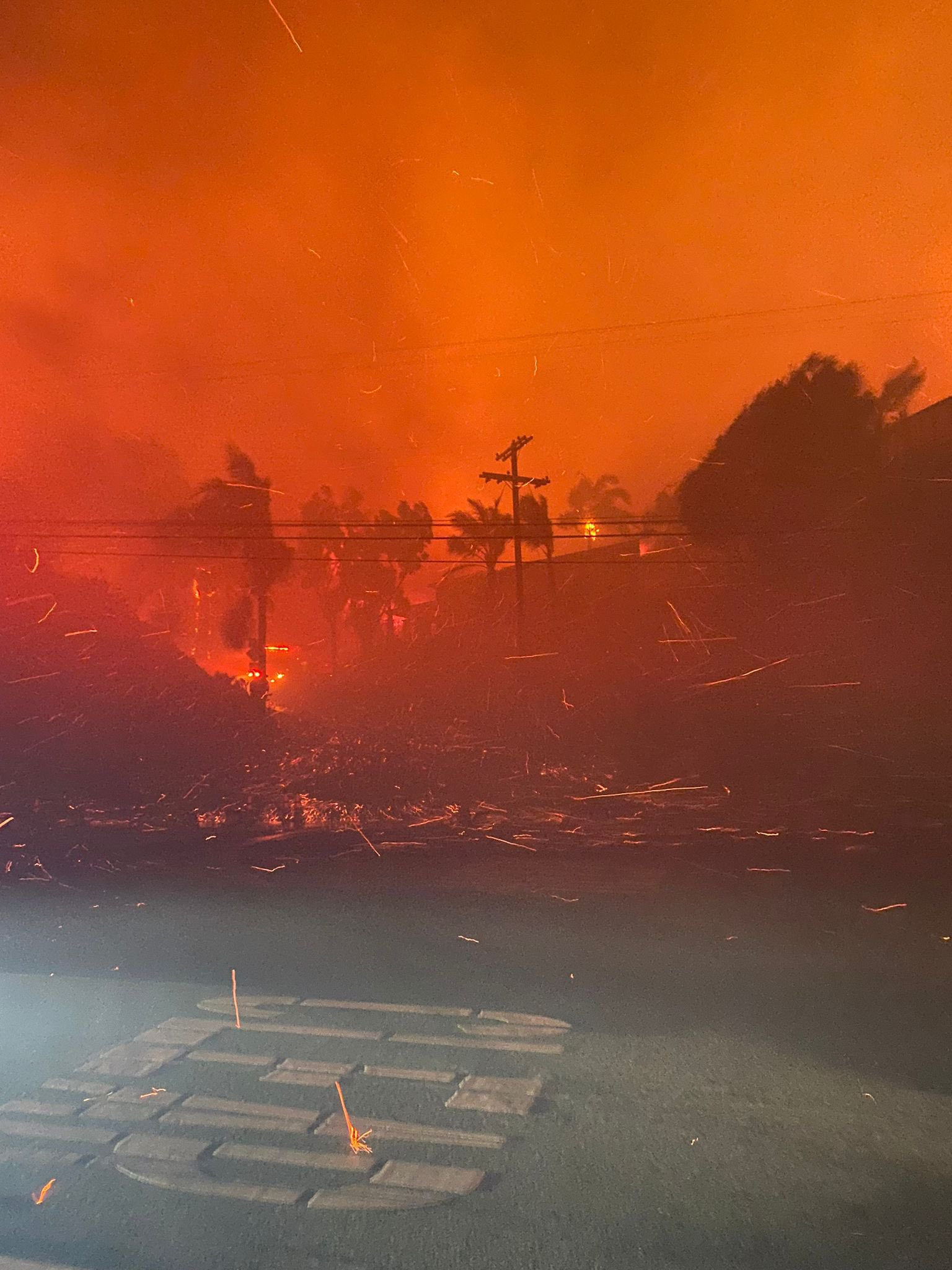
PALISADES FIRE
Incident Summary
The Palisades Fire started this morning at 1030 hours PT from an unknown cause that is under investigation by Fire Officials.
It is located southeast of Palisades Drive in Pacific Palisades, California
###
Current Status
Size Up
The Fire has burned through 2,921 acres and has a 0% containment status.
Structure Status
There have been multiple structures lost and several seriously damaged. It will be a while before a damage assessment can be even started as so many communities are being impacted by fire as we are updating you all through this post. At 1500 PT this afternoon, Fire Officials indicated there were 770 acres with structures that were under immediate life and structure threat.
Fire Behavior
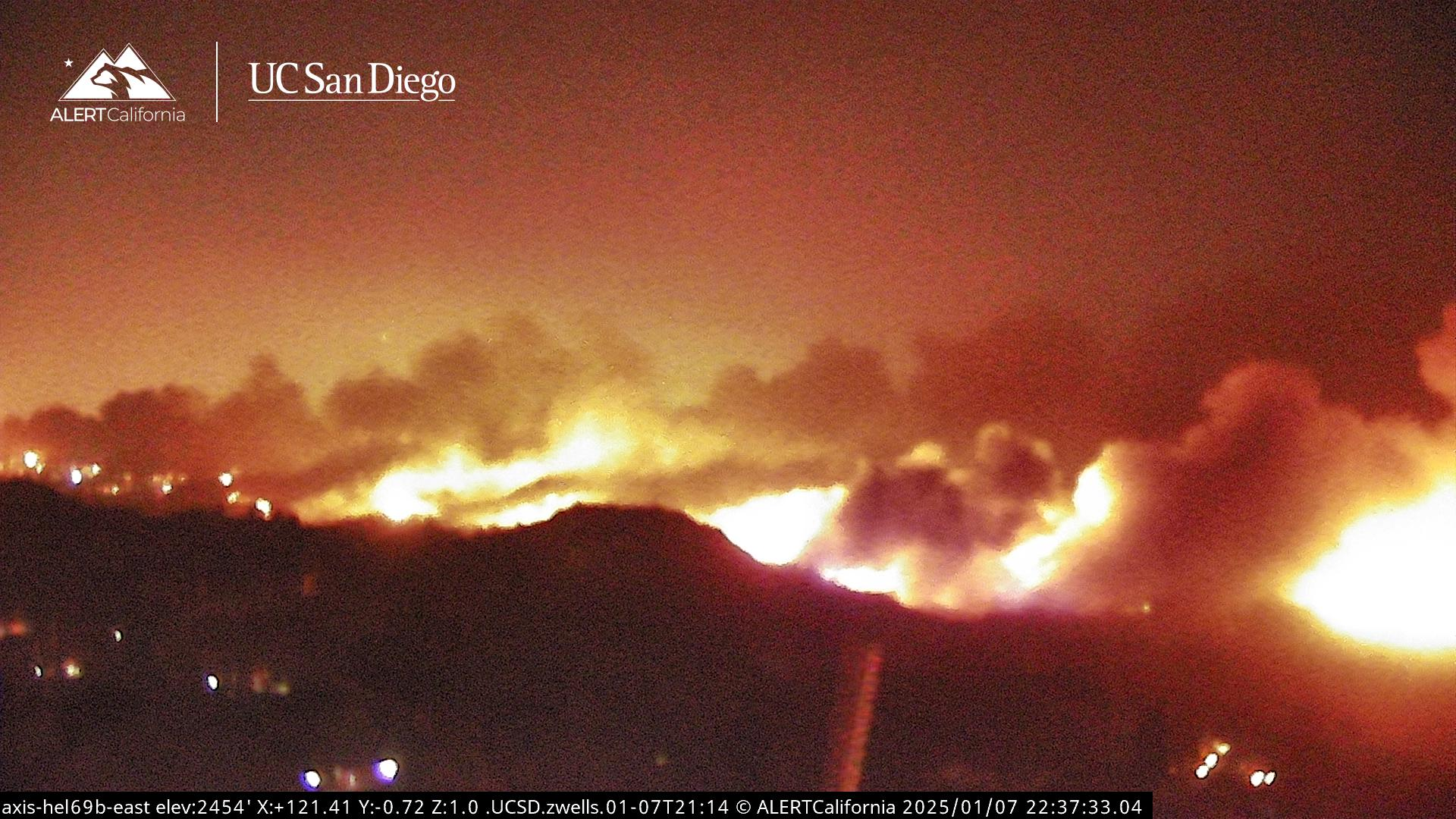
Extreme fire behavior, including short and long-range spotting, continues to challenge firefighting efforts for the Palisades Fire. Winds gusts up to 60 MPH are expected to continue through Thursday, potentially aiding in further fire activity and suppression efforts.
Photo Credit | UC San Diego / CALIFORNIA Alert

Aviation Assets
Due to high winds and danger to aircraft, all aviation assets returned back to their respective bases due to being unable to fly in this weather. This included the helitanker, rotors, and all other aircraft.
A press briefing will be held on Wednesday at 0800 hours at Zuma Beach.
Cause
The cause is unknown and under investigation.
###
Unified Command
CAL FIRE San Bernardino-Inyo-Mono Unit, Los Angeles County Fire Department, Los Angeles City Fire Department, and the Los Angeles Police Department.
Incident Management Team
CAL FIRE Incident Management Team II has been activated to assist Los Angeles County Fire and Los Angeles City Fire. Firefighters will continue to work to protect the community, and infrastructures and gain control over fire containment.
Photo Credit | UC San Diego / CALIFORNIA
Resources
FS 23; Batt 9; West Bureau; Council District 11; AO1 AO2 AP43 AR1 AR11 AR33 AR34 BC4 BC701 BC705 BC706 BC717 BC721 BC9 BP109 BP19 BP74 BP8 BP99 CM40 CM42 CM51 CM52 DZ42 DZ45 E1 E105 E12 E14 E15 E17 E19 E1B E20 E23 E237 E26 E263 E269 E27 E29 E292 E3 E37 E38 E3S E4 E41C E43 E43C E5 E59 E61 E62 E63 E64 E66 E67 E68 E69 E6S E70 E71 E73 E75 E8136 E8137 E8138 E8139 E8140 E85 E90 E93 E94 E98 EA1 EA2 EM17 EM9 FR115 H1 H2 H3 H4 H7 HA1 HA2 HA3 HA4 HA7 HE1 HT3 PB1880 PH1 RA19 RA23 RA37 RA69 RA92 SO1 SU4 T37 T63 T69 WT77; CH5 (1423 PT)
More Resources Ordered: As the fire behavior increased, so did the demand for more fire personnel and equipment. A this time the fire was estimated to be at 200 acres with structures under immediate threat and new evacuation orders in place (mandatory) for NE area (Merrimac Road west to Topanga Canyon Blvd), South (to Pacific Coast Hwy or PCH for short). Westwood Rec Center was opened as an evacuation shelter and with the ability with accepting small animals. Media was staging at the Caldstone’s Restaurant on CA-1 in Pacific Palisades.
FS 23; Batt 9; West Bureau; Council District 11; AO1 AO2 AR1 AR11 BC4 BC701 BC705 BC706 BC717 BC9 BP19 CM40 CM42 CM51 CM52 DZ42 DZ45 E1 E105 E12 E14 E15 E17 E19 E1B E20 E23 E237 E26 E263 E269 E27 E29 E292 E3 E37 E38 E3S E4 E41C E43 E43C E5 E59 E61 E62 E63 E64 E66 E67 E68 E69 E6S E70 E71 E73 E75 E8136 E8137 E8138 E8139 E8140 E85 E90 E93 E94 E98 EM17 EM9 H1 H2 H3 H4 H7 HA1 HA2 HA3 HA4 HA7 HE1 HT3 PB1880 PH1 RA19 RA23 RA37 RA69 RA92 SO1 SU4 T37 T63 T69 WT77; CH5; 1 2. (1223 PT).
1st Alarm Resources: The initial call was for a brush fire in the 1100 block of N. Piedra Morada Drive in the Pacific Palisades, which was said to be approximately 20 acres in size. The fire would quickly spread across the area and increase the fire behavior and Fire Command would request additional resources as a second alarm request. The Command Post and the Media Staging areas were established at this time as well at Fire Station 23 on Sunset / Palisades.
Initial & 2nd alarm resources: S 23; Batt 9; West Bureau; Council District 11; BC4 BC706 BC717 BC9 CM40 CM42 CM51 CM52 DZ42 DZ45 E105 E12 E14 E15 E17 E19 E1B E23 E237 E26 E263 E269 E27 E29 E292 E37 E3S E4 E41C E43 E43C E59 E61 E62 E63 E66 E67 E68 E69 E6S E70 E71 E73 E75 E8136 E8137 E8138 E8139 E8140 E90 E93 E94 E98 EM9 H1 H2 H3 H4 H7 HA1 HA2 HA3 HA4 HA7 HE1 PB1880 RA23 RA69 T37 T63 T69; CH5; 1 2; (1030 PT)
###
Evacuation Orders
Immediate threat to life. This is a lawful order to LEAVE NOW. The area is lawfully closed to public access. Some people are refusing to leave as fire resources are being scattered to check on homeowners and residents, and maybe putting their lives in danger. This fire does not care and will burn everything in its path including your home (which can be replaced, you cannot).
Evacuation Orders are in effect for the following zones:
- LOS-Q0767, MAL-C111-A, MAL-C111-B, RMB-U030-A, SSM-U010-A, SSM-U010-B, TOP-U001, TOP-U002, TOP-U003, TOP-U004, TOP-U005, TOP-U006, TOP-U007, TOP-U008, TOP-U009
Evacuation Warnings
Potential threat to life and/or property. Those who require additional time to evacuate, and those with pets and livestock should leave now.
Evacuation Warnings are in effect for the following zones:
- CAL-C405, CAL-C406, CAL-C407, CAL-C408, CAL-C409, CAL-C410, CAL-C411, CAL-C412, CAL-C413, CAL-C414, CAL-C415, DRY-U026, MAL-C111-A, MAL-C112, MTN-U028, RMB-U030-A, RMB-U030-B, RRC-U027, SDP-U029
Evacuation Shelter(s)
Westwood Recreation Center
1350 South Sepulveda Blvd
Los Angeles, CA 90025
El Camino Real Charter High School – NEW!
5440 Valley Circle Blvd
Woodland Hills, CA 91367
###
Road Closures
Follow CHP-West ValleyExternal Link to stay up-to-date on road closures for the Palisades Fire.
- Southbound Pacific Coast Highway at Las Flores Canyon Rd
- Southbound Pacific Coast Highway at Topanga Canyon Boulevard
- Coastline Drive and Southbound Pacific Coast Highway
Social Media
We are using the following hashtags for this post: #CAwildfires2025 #PalisadesFire
(c) 2025 NW FIRE BLOG
