
Published Saturday, May 20, 2023
Many wildfires are burning throughout the Canadian territory burning mainly in the Province of Alberta. This is a recap of SOME of the wildfires burning in their country, as there are almost 100 fires burning and too many to list here on our fire news page.
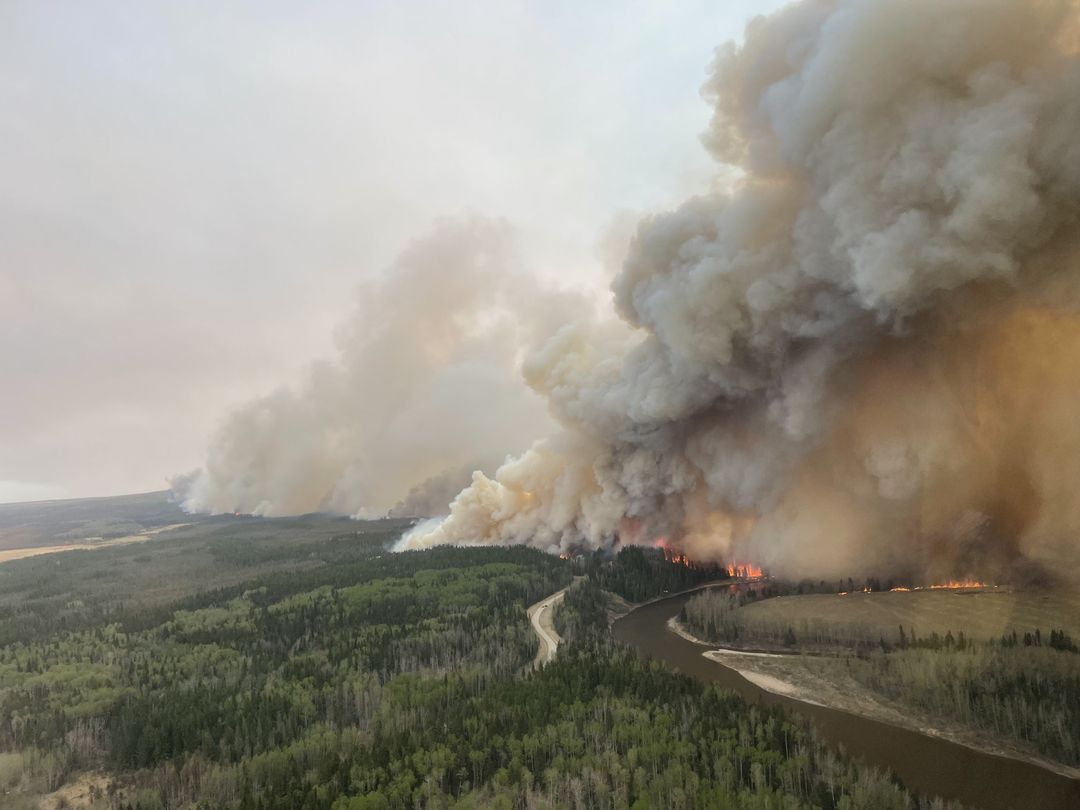
Photo Credit | Alberta Wildfire
GWF084 Fire
This fire is under control, which was originally started on November 2022 at 1310 hours is under control. It was lightning-caused. 22.30 ha. Incident Type 5. Located in the Grande Prairie Forest Area.
F I R E F A C T
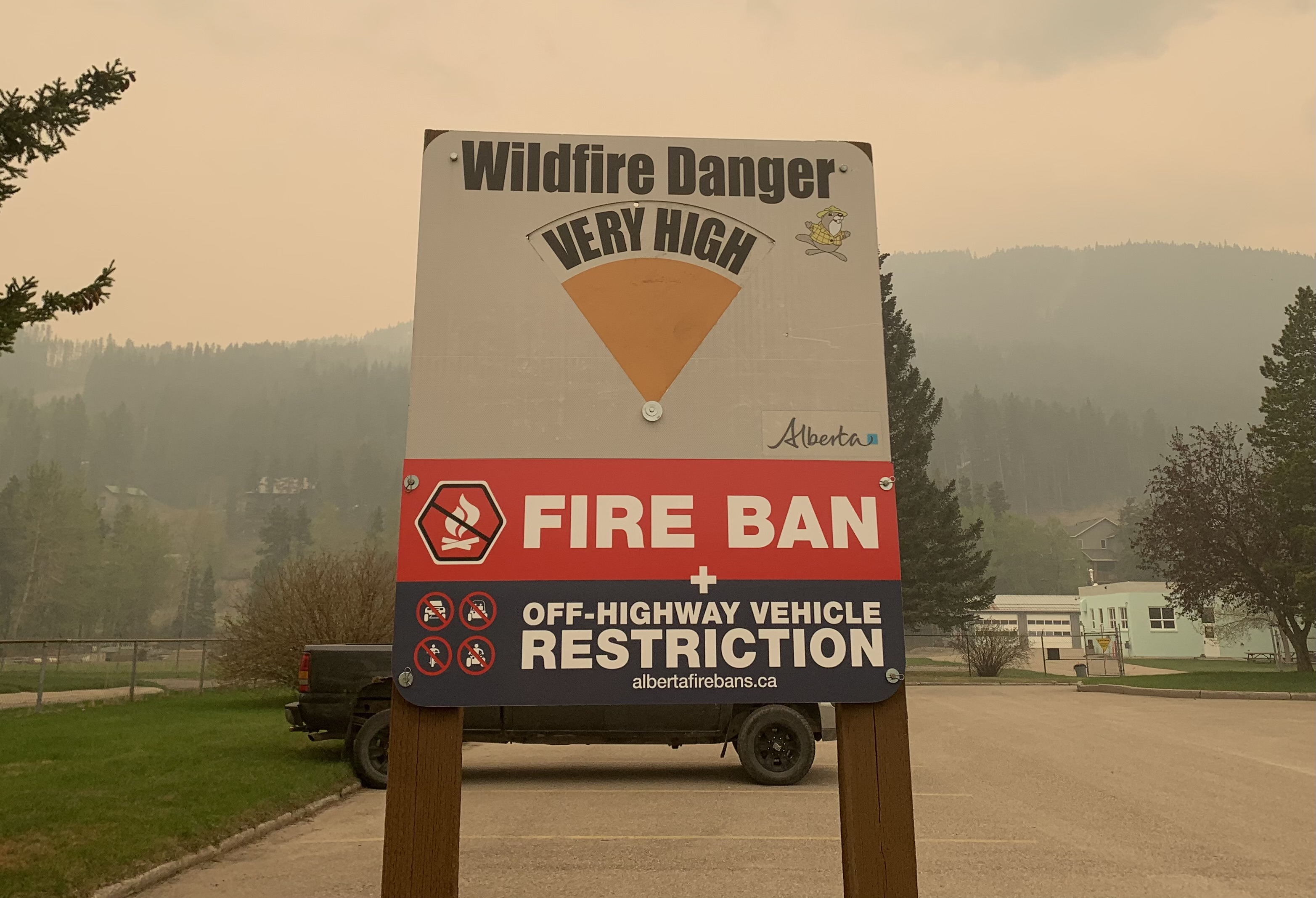
As of January 1, 2023, there have been 496 wildfires recorded in the Forest Protection Area of Alberta that have burned 842,294.8 ha.
Source: Alberta Wildfire
GRIZZY COMPLEX
The Grizzly Complex has three fires, the SWF063 which is about 69,074 hectares, SWF064 with 22,398 hectares, and the SWF-057. On May 13, 2023, Social reports stated evacuation order levels were reduced to warnings. Without a full assessment, a minimum of 27 residential structures have been destroyed in the East Prairie Metis Settlement.
SWF063 Fire | 69,074 ha. Out of control. Lightning caused. Located in the Slave Lake Forest area. Under a complex in an area of 92,742 ha.
SWF064 Fire | 22,398 ha. Fire is considered out of control. Lightning caused. Located in Slave Lake Forest Area.
SWF057 Fire | unknown size.
FIRE FACT
There are currently 86 wildfires burning in the FPA with 25 of them being considered out of control, 15 being held (mop up) and 51 being under control.
COWBOY TRAIL FIRE
The Cowboy Trail Fire is located N of Hwy 624 between Range Roads 72 and 73. A mandatory evacuation of the area is being considered by local officials, if the threat to public safety occurs. An evacuation warning has been issued for those residing at E of Hwy 22 to Range Raod 72, N of Hwy 624 to Township Road 512. Estimated 4 ha. A double-wide fire guard was created as a fire break to stop the forward progression of the fire.
Source: Parkland County
FIRE FACT
With a large number of fires currently burning across Canada, the Canadian Interagency Forest Fire Centre has requested assistance from Australia and New Zealand. The #NSWRFS is currently coordinating the NSW contingent in conjunction with the National Resource Sharing Centre.
New South Wales will provide almost 60 firefighting personnel as part of the 200-strong Australian contingent, which includes incident management personnel and arduous firefighters. The NSW team will depart Sydney next week, with the deployment expected to last up to a month.
Source: NSW Rural Fire Services
Photo Credit: Alberta Wildfire
STURGEON LAKES COMPLEX
Surgeon Lake Creek Nation
This complex includes two wildfires GWF017 with 3,765 ha and GWF023 with 1,189 ha. About 1,600 residents are still under evacuation orders in the Sturgeon Lake Creek Nation. At least 45 structures have been reported lost.
GWF017 Fire | 3,765 ha.
GWF023 Fire | 3,269 ha. The cause is under investigation. Incident Type 5. Grande Prairie Forest Area.
STATE OF EMERGENCY DECLARED
Hot and dry conditions continue to plague multiple areas of the province causing high and dangerous conditions making it ripe for wildfires to ignite and explode into firestorms. A provincial state of emergency has been declared.
PEMBINA WILDFIRE COMPLEX
EWF031 Fire
25 km W of Lodgepole
Detected on May 4th. It is located 25 km west of Lodgepole, 26 km northwest of Brazeau Dam, and 14 km southeast of Edson. This is an out-of-control fire and has burned about 113,244 ha. The increased size is attributed to growth that has been observed over the last couple of days and due to more accurate mapping. A containment line is established on the northwest tip of the fire.
Personnel: A total of 76 firefighters are assigned along with an overhead team between this wildfire incident and the EWF039 Fire. About 23 pieces of heavy equipment along with seven helicopters are supporting these two fires along with an air tanker group on standby in staging.
Northwest corner: Active fire is burning on the south side of the northwest corner, which has increased today, causing operational fire suppression challenges. There is limited visibility in the area due to heavy smoke, prompting Fire Command to pull crews from the fireline until it was safe to return. Planned ignition operations were not completed due to safety concerns. They will re-engage when conditions improve.
Weather Conditions: Isolated or scattered rain and thundershowers were forecasted for today and tomorrow. Moderate to strong north/northwest winds will develop late Sunday into Monday and Tuesday. Periods of rain will develop Monday and Tuesday.
EWF039 Fire
Near Carrot Creek Lookout Tower
The wildfire is located near Carrot Creek, and is currently under control or in U.S. Fire terms, is in mop-up stage 165 ha.
RWF034 Fire
Near O’Chiese Reserve
The fire is located near the O’Chiese Reserve and has been classified as out of control. Estimated 82,869 ha. Increased size due to more active fire behavior over the last several days. 49 firefighters and overhead personnel are assigned along with five copters and four additionally assigned to the overall Complex. 23 pieces of heavy equipment are actively being deployed.
RWF040 Fire
NE of Forestry Trunk Road x Brown Creek Provincial Rec Area
This wildfire is located 6 km northeast of the Forestry Trunk Road and Brown Creek Provincial Recreational Area and is classified as out of control. Fire being monitored. The estimated size is about 4,544 ha. Most of the fire growth has occurred to the west. The Blackstone Lookout Tower in the area is not currently under threat.
FIRE FACT
There are seven mutual aid wildfires in operation that Alberta Wildfire is assisting with.
Source: Alberta Wildfire
DEEP CREEK WILDFIRE COMPLEX
An incident management team from the U.S Forest Service along with many of their firefighters arrived on May 14 to assist our area with one of the three wildfire complexes in the area. We want to thank our American friends for coming to assist us. A special arrangement has been in place for many years between Canada, the U.S., Australia, and other countries that have similar firefighting training standards. We take safety and training very seriously and always seek to improve our operations.
WCU001 Fire
SE of Entwistle, W of Pembina River
This fire was detected on April 29 and is classified as out of control. It is about 7,281 ha. No new growth has been reported outside of the fire perimeter. It is located SE of Entwistle and W over the Pembina River where it spread north. It traveled over Hwy 16. The wildfire is parallel with Hwy 16 and moved further west where the wildfire spread just north of Wildwood and now rests at Chip Lake. There is unburned vegetation in the interior. Large smoke columns may be seen coming from the fire. Copters will drop water on hotspots and rekindle. Crews will continue working in areas of deep peat south of WCU001 that are within the fire perimeter. Highway 16 will experience smoke from the active wildfire zone due to the hotspots near the highway.
WCU002 Fire
Both sides of Hwy 22, N of Hwy 16
This fire was detected on the evening of April 29 and is a mutual aid wildfire located on both sides of Hwy 22, and, N of Hwy 16. The wildfire is currently burning out of control. The estimated size is 2,400 ha. No new growth was reported. Decreased fire behavior with torching. E of Range Road 92 and W of Range Road 75.
EWF035 Fire
3 km E of Shining Bank
The EWF035 Fire was detected on May 5. This wildfire is classified as out of control and estimated to be 18,608 ha in size. The fire doubled in size yesterday but did not increase to the NE or NW. The wildfire is now S of Township Road 570, burned down to the S, two kilometers north of the railroad track in Niton Junction. The fire moved across Rge Rd 123 and burned along the Lobstick River.
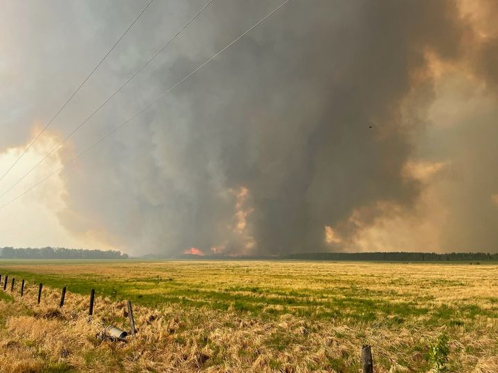
Photo Credit | Alberta Wildfire
There was significant growth yesterday. The fire burned toward the SE and then toward the S later in the day.
Fire behavior is extreme with a high rate of spread at the beginning of its igniting.
Today, firefighters didn’t record very much fire activity thanks to quiet winds and smoke which is smothering the wildfire.
The weather tomorrow will be more favorable for wildfire firefighters. Temperatures will be in the mid to high 20s but the relative humidity is expected to be near 30% with some precipitation.
Monday, we expect slightly lower temperatures and higher humidity with winds from the northwest. More rain is forecasted, however, we’ll need significant precipitation to improve these hot and dry conditions.
SOUTHEAST OF EWF035
Yesterday, the fire intensity was increasing quickly near 11:00 a.m. and progressed to extreme fire behavior by noon. The fire spread quickly to the south-southeast through spruce stands and as of 5:00 p.m., the fire moved directly towards the south.
Medium helicopters were bucketing around structures where conditions permitted but had to move away from the wildfire as winds and smoke made it difficult to bucket safely and effectively. Heavy helicopters were also present yesterday, bucketing on structures and around homes, attempting to cool the conditions near the community. The heavy (large) helicopters were available today to assist with the fire but none of our aircraft could take off today due to smoky conditions and poor visibility.
Today, seven pieces of heavy equipment were re-positioned and tasked with new lines while the fire activity is favorable for them to work near.

On Thursday, air tankers had built a containment line with retardant on the southwest side of the fire. The fire burnt over it very quickly yesterday. Under these extreme fire behavior conditions, helicopter water buckets, water skimmers, and air tankers with retardant are often not effective due to the heat.
Firefighters reported seeing 150 ft high flames from the trees and estimate that the fire moved approximately 60 meters per minute. They are effective under certain conditions and not always the best tool for the job. The fire also can spot ahead of itself and over containment lines of any type, especially under these rates of spread. Firefighters could see spotting from the wildfire up to 500 meters ahead of itself, making these conditions very challenging for firefighters.
NORTHWEST OF EWF035
Dozer operators and landowners were assisting with a dozer line to help contain the fire from the 560 moving south along East Bank Road, on the east side of the road. Although we appreciate the help from the public where possible, this is a special situation where the landowners are able to work closely with the industry in ensuring the safety of the pipelines and the operators.
Today, firefighters continued to reinforce the containment line they’ve built with hand ignition burning operation from East Bank Road and moved into the interior of the fire. This burn will add protection to nearby properties, removing available fuel for the fire later on, if the winds change direction. The operation is successful, the winds were in favor of firefighters yesterday and continue to be for them today. The fire did spot across the river into agricultural land in a few places and fortunately, the landowner was able to put out the hotspots on their land. Firefighters are also patrolling along the East Bank Road extinguishing hotspots on the west side of the road.
NORTHEAST OF EWF035
Firefighters successfully established a containment line that runs from the 570 down to the 560 on the east side of the wildfire. They nearly completed the hand ignition burn operation, removing as much fuel as possible in the area. Firefighters had to cease their operations as relative humidity and the vegetation was too wet to burn.
We are asking the public to use extra caution around wildfire operations and not walk into burnt areas. There are unseen hazards, like deep burning ash pits, falling trees because their roots have been burnt away and aren’t stable as well as other unknown dangers. Firefighters are highly trained individuals who wear special gear when working near wildfires. We understand that these are stressful times and we assure you we are doing what we can to chase this ever-moving wildfire shifting from one side to another on a daily basis.
If you see aircraft in the area, we ask that you move away from the area. They cannot do their job effectively. You may be unintentionally impeding our operations, please give our firefighters the room and time they need to complete their tasks.
THROUGH THE EYES OF SOCIAL MEDIA
“Paramedics, firefighters & dispatchers are doing everything they can to fill in the gaps, but Alberta’s EMS crisis is pushing all first responders to a breaking point. As wildfires rage on across AB, we’re left with even fewer resources to help our communities. Lives are at risk.” – AB Professional Fire Fighters & Paramedics
“The U.S. is supporting @CIFFC in Canada with #FireFightingResources. Some resources include supplies to aid #FireFighters in #wildfire suppression. The Great Basin Cache at NIFC recently sent communication equipment, potable tanks, and pumps to Alberta, Canada.” – National Interagency Fire Center (based out of Boise, ID USA)

“Canada is burning, Italy is flooding, India is overheating, Sudan is drowning, Spain is drying out, and more, and almost no reaction from politicians or the media.” – Social media
“This is terrifying. The numerous #fires across Canada have turned the skies orange in Calgary.” – @WeatherNation
“Forest Service firefighters from the Pacific Northwest have joined others to support Canada with active wildfires. The Wolf Creek, Prineville, and Baker River Interagency Hotshot Crews are among ten hand crews traveling to assist with wildfire suppression efforts in Alberta.” – Forest Service NW (USFS)
“The last time firefighters from Canada assisted in the US was in 2021, when two hand crews from Canada helped with wildfires here in the Pacific Northwest.” – Forest Service NW
“In addition to the federal firefighting resources mobilized, several state wildland fire agencies are also providing personnel and equipment to support the wildfires burning in Canada. The Northwest Wildland Fire Protection Agreement (Northwest Compact) has been in place since 1999 between Canada (Alberta, British Columbia, Yukon Territory, Saskatchewan, and Northwest Territories/Forests) and the States of Alaska, Idaho, Oregon, Washington, and Montana.
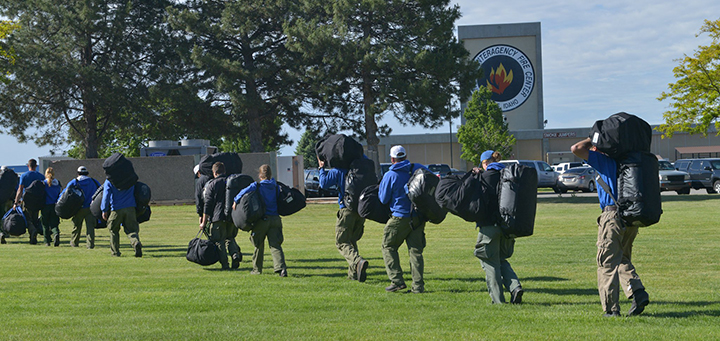
Through this agreement, states have dispatched approximately 125 personnel and equipment including ground and air from the following states: Alaska (one air tanker and the Pioneer Pike Hotshot Crew), Washington (miscellaneous firefighting personnel, one initial attack hand crew, and three engines), Montana (three incident management personnel), and Oregon (26 incident management personnel). Additionally, Oregon and Washington (including local fire service) have combined personnel to create a shared incident management team.” – National Interagency Fire Center
“Alberta is literally on fire tonight.” – Canadian News Media
“Wildfires have forced thousands of people from their homes in the province, prompting some calls to delay the May 29 provincial election.” – CBC News
“It’s like a scene out of Blade Runner. Heavy smoke from wildfires burning across Western Canada has blanketed Calgary, turning blue skies into an eerie orange glow.” – CBC News
VOLUNTEER INFORMATION
Volunteers, equipment owners/operators, or firefighters looking to assist with these wildfires or any of the wildfires within the province, please contact EmergencySupportOffers@gov.ab.ca. Please do not contact Edson Forest Area logistics directly, as they are extremely busy supporting the wildfire situation in the area.
CRISIS RESPONSE: (Facebook) https://www.facebook.com/crisisresponse/263853669429859/?alias=263853669429859&source=search
(c) 2023 NW Fire Blog
