

Rail Ridge Fire
Photo Credit: Rail Ridge Fire Officials

Published Sunday, September 8, 2024, 1615 Hours PT
INCIDENT SUMMARY
BURNS, OREGON — The RAIL RIDGE FIRE is burning about 41 miles northwest of Burns and 14 miles south of Dayville, Oregon in the Prineville District of the area of Bureau of Land Management lands. It was detected on September 2, 2024, which was caused by lightning.
CURRENT STATUS
Evacuations | Evacuation orders are in effect.
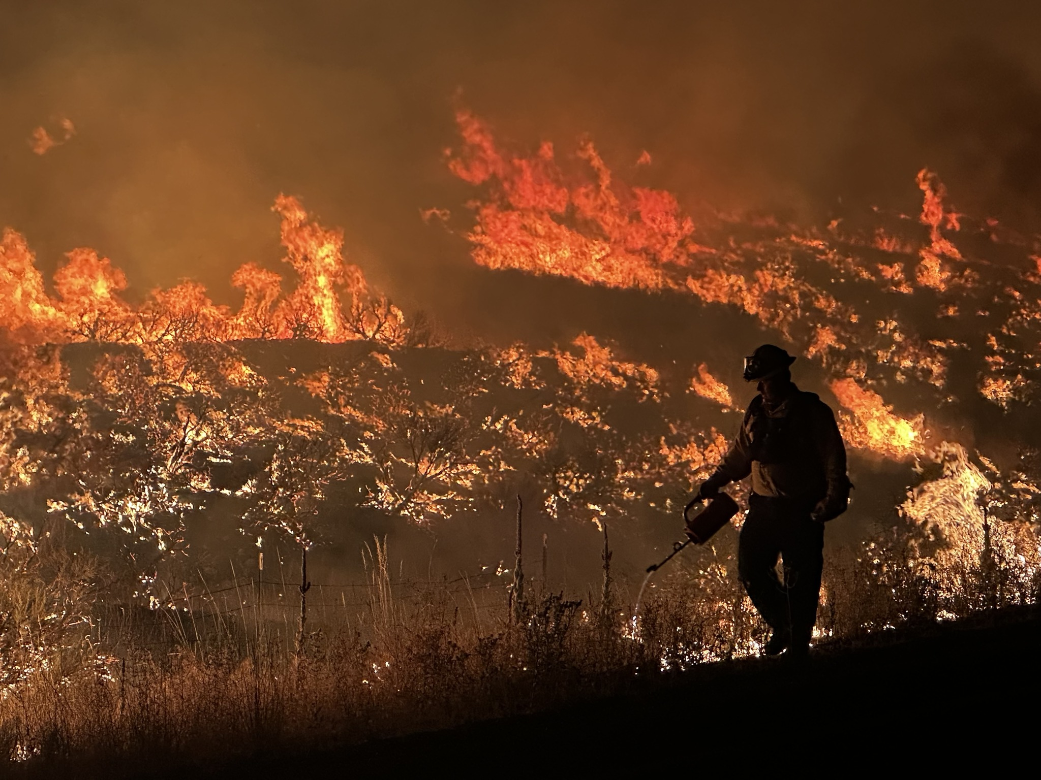
Fire Behavior | Extreme with short crown runs, torching, and long-range spotting.
Size Up | There have been 121,923 acres burned and there is a 7% containment status.

(L) Photo Credit | Rachel Brozovich, OSFM
Fire Operations | “Multiple thunderstorms were observed over the fire area. Most fire activity was observed on the northern edge of the fire again, as it burned through timber stringers and sage fields. It continues to be hung up on the ridge south of Dayville/Highway 26 west of the South Fork Road. Additional Oregon State Fire Marshal (OSFM) task forces arrived on Saturday from Benton and Washington Counties, as well as two from Washington State. Overnight, these crews focused on gaining situational awareness along the fire line, identifying and assessing structures in their assigned areas. Significant fire activity is expected to continue today. Crews will extend structural surveys and surface preparation around the Dayville area. OSFM crews will continue to support wildland operations while assessing and actively addressing structure threats. On the eastern and southern edges, the fire held within proposed containment lines, giving firefighters time to build and improve lines. Wildland, local, and OSFM crews held the fire along the Paulina Suplee Highway and provided protection to structures directly adjacent to the fire line.
Weather | The weather today is predicted to remain unsettled, with showers and occasional thunderstorms continuing through the morning. Clearing is anticipated for the afternoon, with light and variable winds and some relief from the heavy smoke. This clearing could result in more active fire behavior again. Winds are expected to remain light, although convective activity could result in stronger, erratic gusts. Daytime temperatures are expected to trend downward in the coming days, although vegetation will remain critically dry, and any new starts from the current lightning are anticipated to find fuels receptive for growth.” – USFS
RESOURCES
Staffing/Equipment | 636 personnel with 12 crews, 78 engines, and 2 copters (cannot fly due to poor visibility).
Photo Credit | Rail Ridge Fire Information
Agencies | US Forest Service-Malheur National Forest, Central Oregon Fire Info, Grant County (WA) Emergency Management.
ASSESSMENTS
Threatened | 236 single-family residences, 10 multiple-family homes, and 419 minor structures, along with communication infrastructure, and sage-grouse habitat, are under being threatened.
Damage Assessment | 7 structures (6 single-family homes and 1 minor residence) have been lost. CTD has reached 2.2 Million Dollars
(c) 2024 NW Fire Blog
