

January 21, 2025, Tuesday Fire Update
There have been 34,354 total emergency responses per CAL FIRE, that have resulted in 227 wildfires that have burned 40,687 acres and caused 28 deaths. There have been 15,798 total structures destroyed.
The EATON FIRE was sparked by an unknown source, which started at 1818 hours PT on January 7, 2025, near Altadena Drive and Midwick Drive in Altadena / Pasadena (Los Angele County), California.
The cause is under investigation by LOCAL, COUNTY, STATE, and FEDERAL agencies.
Today, the fire has burned about 14,021 acres and there is an 89% containment status.
Photo Credit | CAL FIRE

Evacuation orders and warnings are still in effect. Other pertinent information can be found on this website: CAL FIRE: https://www.fire.ca.gov/incidents/2025/1/7/eaton-fire
Officials state they have completed 99% of the structure damage assessments and here is a breakdown of their team’s preliminary numbers:
- Damaged: 1,071
- Lost: 9,418
- Deaths: 17
- Injuries: 8
According to the National Interagency Fire Center’s Daily Incident Situational Report, today’s cost-to-date has reached 78 Million Dollars for fire suppression and containment efforts.
Per CAL FIRE:
Firefighters continue to mop up and extinguish hot spots within the perimeter of the fire. The repopulation of residents is ongoing, with zones being released in phases to ensure the safety of public and utility agencies.
Photo Credit | LA County FD

Numerous calls for service continue to be received from communities that are repopulating. The Infrastructure Group is being utilized to assist Public Works with the clearing of roadways and opening of storm drains. Southern California Gas reported that service has been restored to 3,040 structures. Southern California Edison reported that service has been restored to 11,862 structures, with 7,549 remaining. Fire Suppression Repair is nearing completion.
Photo Credit | County of Los Angeles
Resources continue to be staged in La Cañada along the western flank of the fire, ready to respond to any new fire starts or fire activity within the current footprint.
The Particularly Dangerous Situation (PDS) Red Flag Warning expires today at 10 a.m.. Northeast winds will gradually decrease through the morning and conditions will remain critically dry with extremely low relative humidity.
Per LOS ANGELES COUNTY SHERIFF’S OFFICE
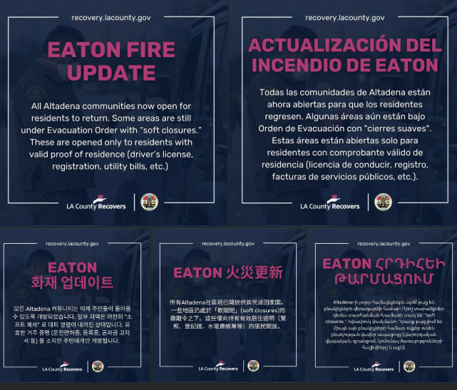
Eaton Fire Update for Tuesday, January 21st, 2025: Repopulation and Safety Guidelines
The Los Angeles County Sheriff’s Department is announcing the following evacuation zone status changes of communities impacted by the Eaton Fire effective 12:00 P.M. on Tuesday, January 21st, 2025.
The following areas have been modified.
§ Orders are Modified: Evacuation Warnings have been lifted for the following areas:
§ located inside the unincorporated county area of the Altadena Community:
§ East of North Fair Oaks Avenue, North of East Harriet Street and East Mendocino Street, West of North Lake Avenue South of East Altadena Drive
§ East of Sunny Oaks Circle, North of East Altadena Drive, West of Eaton Canyon (Open Space), South of Rubio Canyon
§ East of North Lake Avenue, North of East Mendocino Street, West of North Allen Avenue, South of East Altadena Drive
§ East of Lincoln Avenue, North of West Harriet Street, West of North Fair Oaks Avenue, South of West Altadena Drive § For those using protect.genasys.com, these zones are listed as
§ ALD-CALAVERAS-A
§ ALD-EASTLOMA
§ ALD-MENDOCINO-A
§ ALD-WHITEPARK-A
The following areas remain open to residents only.
§ Orders Remain: Evacuation Order with “soft closures” for the following areas:
§ located inside the unincorporated county area of the Altadena Community:
§ East of Lincoln Avenue, North of West Altadena Drive, West of Olive Avenue, South of West Loma Alta Drive
§ East of Olive Avenue, North of West Las Flores Drive, West of Fair Oaks Avenue, South of West Loma Alta Drive
§ East of Olive Avenue, North of East Altadena Drive, West of North Lake Avenue, South of West and East Las Flores Drive
§ East of Fair Oaks Avenue, North of East Las Flores Drive, West of North Marengo Avenue, South of East Loma Alta Drive
§ East of North Marengo Avenue, North of East Las Flores Drive, West of North Lake Avenue, South of East Loma Alta Drive
§ East of North Lake Avenue, North of Wapello Street and East Palm Street, West of Sunny Oaks Circle, South of The Cobb Estate
§ East of North Lake Avenue, North of East Altadena Drive, West of Madison Lane and Crest Drive, South of Wapello Street and East Palm Street
§ East of North Sunset Ridge Road, North of West Loma Alta Drive, West of Taos Road, South of Chaney Truck Trail
§ East of Taos Road, North of East Loma Alta Drive, West of Altadena Crest Trail, South of Mt Lowe Road § For those using protect.genasys.com, these zones are listed as
§ ALD-GARDEN
§ ALD-LAUREL
§ ALD-PALM
§ ALD-WAPELLO
§ ALD-FARNSWORTH
§ ALD-RUBIO
§ ALD-MOUNTLOWE
§ ALD-CHANEY
§ ALD-CANON
§ Entry and Exit Points are located at the following intersections:
§ Altadena Drive and North Fair Oaks Avenue
§ West Altadena Drive and Lincoln Avenue
§ East Altadena Drive and North Lake Avenue
§ West Loma Alta Drive and North Sunset Ridge Road
A soft closure means the area is closed to the general public. It is still open to disaster crews, public safety personnel, and residents with identification only. Only residents with valid proof of residence (driver’s license, registration, utility bills, etc.) are allowed to enter and exit the soft closure area. Peace officers and the National Guard will still be at checkpoints and will ask for identification.
Please have it ready to expedite the process. Motorhomes, trailers, and moving trucks are not permitted into the fire area at this time. Please do not remove anything from within your property, this includes any debris.
Please refer to Public Health announcements regarding health and safety measures. Public Works of Los Angeles County has a debris removal program.
The Fire Department will coordinate an assessment of fire debris. Fire inspectors will provide the necessary clearances for the safe removal of fire debris. Once hazardous materials are removed, the County will launch a debris removal program to assist private property owners in safely clearing debris. Please visit recovery.lacounty.gov for ongoing updates and guidance.
Residents are reminded to exercise caution and remain mindful of Edison work crews operating in the area. For your safety and the safety of the crews, please adhere to all posted signs, avoid entering work zones, and keep a safe distance from ongoing operations. We appreciate your cooperation in helping ensure everyone’s well-being during these necessary maintenance activities.
The County of Los Angeles Department of Public Health has issued orders prohibiting the unsafe removal, transport, and disposal of fire debris to protect community safety.
The following link can be used to assist the public in determining if their property is in an area that can be entered: https://protect.genasys.com/ and searching for the EATON FIRE. The link connects users to an evacuation map, maintained by CalFire.
The Fire Incident Command continues to monitor the active fire areas, as well as those areas remaining closed due to critical infrastructure concerns or safety hazards.
The Los Angeles County Sheriff’s Department with our Public Safety partners has a strong presence in the repopulated and evacuated areas to ensure the protection of our residents and their property. All other road closures and evacuated areas for the EATON FIRE remain in effect.
If you return to your property and discover anything that you suspect may be human remains, we urge you to avoid disturbing the site.
Please immediately contact your local Sheriff’s station. A team comprising our Homicide Bureau, the Medical Examiner’s Office, and Arson and Explosives Detail investigators will promptly respond to secure and investigate the scene.
Safety Tips for Returning to Fire-Affected Areas As you prepare to return home after a fire evacuation, your safety remains our top priority. Please keep the following tips in mind to ensure a safe and smooth return:
§ Follow Public Health and Safety Orders.
§ Be Careful of Damaged Trees and Structures Due to High Winds Being Forecasted.
§ Follow Official Guidance: Only return to your property when authorities have declared it safe to do so. Conditions can remain hazardous even after the fire is contained.
§ Inspect Your Surroundings: Be cautious of unstable structures, downed power lines, or weakened trees that may pose risks. There may be uncleared hazards in the roadway.
§ Wear Protective Clothing: Sturdy shoes, gloves, and a mask to protect yourself from debris, ash, and airborne particles.
§ Mind Health Hazards: Avoid direct contact with ash, which may contain toxic substances. If you have respiratory conditions, limit your exposure to ash and smoke, and use an N95 mask if necessary.
§ Check Utilities before use: Do not attempt to restore power, gas, or water until a professional has inspected the systems. Report any visible damage or strong odors like gas to utility providers immediately.
§ Document the Damage: Take photos and notes of any damage before beginning cleanup. This will be important for insurance claims or assistance requests.
§ Emotional Well-Being: Returning after a fire can be overwhelming. Take breaks, reach out to loved ones, and consider talking to a counselor or support group if needed.
Windblown Dust and Ash Advisory The Los Angeles County Department of Public Health is issuing a Windblown Dust and Ash Advisory following strong Santa Ana winds.
Windblown dust and ash contain small particles that may cause irritation or exacerbate pre-existing health conditions, particularly for children, older adults, pregnant individuals, and those with heart or lung conditions. Public Health advises everyone to take the following precautions to reduce exposure:
§ Stay Inside: Keep windows and doors closed. Use an air purifier or run your air conditioning system on recirculate to keep indoor air clean.
§ Wear a Mask: If you must go outside, wear an N95 or P100 mask to protect your lungs.
§ Secure Loose Items: Tie down or bring in items like chairs, trash cans, and other outdoor belongings to prevent them from becoming hazards.
§ Protect Your Eyes: If outside, wear goggles to shield your eyes from airborne ash and debris.
§ Stay Informed: Monitor updates from local news sources for the latest on weather conditions, air quality, and potential evacuation notices.
§ Be Prepared: Have a plan in place in case conditions worsen, including essential supplies and emergency contacts.
The public is reminded to stay vigilant on current fire conditions. Please continue to adhere to road closures and any evacuation warnings. A reminder to drive slowly and yield to emergency personnel in the area. There will still be smoke in the respective areas as firefighters continue firefighting operations. If at any time you feel unsafe, please call 911.
Remember, utility workers are continuing to repair damages as you repopulate the area. Power, water, and gas utilities may still be affected.
Please report any visible damage or strong odors like gas to utility providers immediately. Your safety remains our number one priority.
Your safety and resilience are what matter most. If you have questions or need assistance, local resources and authorities are here to support you every step of the way.
For information regarding other municipalities affected by the Eaton fire, please visit:
City of Arcadia https://www.arcadiaca.gov/
City of Monrovia https://www.monroviaca.gov/…/city…/city-news-highlights
For more general safety information please visit the following websites: Los Angeles County Eaton Fire Emergency https://lacounty.gov/emergency/
Los Angeles County Fire Department https://fire.lacounty.gov/home-safety-tips/
Los Angeles County Public Health http://publichealth.lacounty.gov/media/WildFire/
Housing https://www.lahsa.org/news…
Southern California Edison https://www.sce.com/wildfire/wildfire-safety
The Southern California Gas Company https://www.socalgas.com/fires
The Red Cross https://www.redcross.org/…/california-wildfires…
FEMA Debris Removal | FEMA.gov
INCIDENT COOPERATOR SPOTLIGHT
BC Wildfire Service
Photo Credit | CAL FIRE
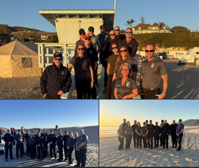
Through an existing Memorandum of Understanding (MOU) with BC Wildfire Service (BCWS), a total of 13 employees assisted CAL FIRE Incident Management Team 2 at the Palisades Incident beginning January 11th through today.
The BCWS members immediately integrated into the Incident Management Team, assisting with a variety of ICS positions including Public Information, Planning, Air Operations, Liaison, and Incident Command.
This opportunity provided each agency the ability to identify subtle differences in process, allowing for even further collaboration and integration in the future.
As fire departments worldwide have seen larger and more destructive fires, no one agency can be successful alone, and collaboration benefits everyone.
We’re grateful to our partners from British Columbia as well as all the other states and countries that have come to assist in our time of need. – CAL FIRE
Ed. note: We love that others came from all over the United States, our neighbors & allies, Canada, Mexico, and all over the place. Thank you to each and every one of you for helping our friends in California. #FireFamily #OneFamily #TeamworkMakesTheDreamWork
(c) 2025 NW FIRE BLOG
