

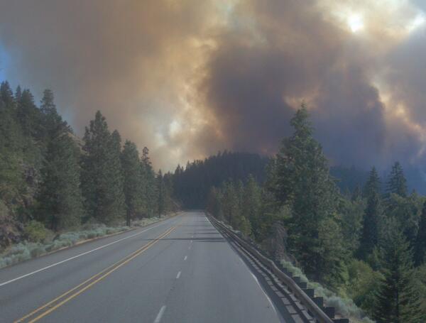
Goldendale, WA – The Satus Pass fire has now been renamed by Washington DNR as #MileMarker28. This fire originally started approximately 1100 on Wednesday, July24, 2013, is approximately 15 miles NE of Goldendale and along Highway 97. It is currently burning grasslands, shrubs, timber and timber litter.

The WA Interagency Incident Management Team 2 assumed command of the fire on 1200 on Thursday, July 25. They are currently with the Yakama Nation and DNR. Cooperators include: Klicktat Sheriff’s Office, Emergency Management, Fire Districts 7 and 2, American Red Cross, Bonneville Power Administration, PUD and WSDOT.
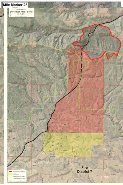
As of 1500 hours this after, the Klickitat County Sheriff’s Office upgraded the evacuation to a level 3 for all residences East of Hwy 97 and South of Box Canyon (to Southern Boundary of Township 5, Range 17E, Sections 20-24), Southern Boundary at Thompson Tail Road at 97 and runs East to where Old Mountain Road turns South at Grady Lane.
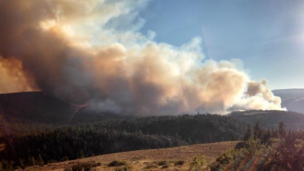
There are currently 800 personnel on scene with three-percent (3%) containment. Over 4600 acres have burned. Steep topography makes direct attack difficult. Wind speed is 6-12 mph North with temps in the 85-95 degree range with a humidity of 10-15 percent.
Highway 97 still remains closed between Toppenish and Goldendale and WSDOT is asking drivers to avoid the area, using alternatives routes on SR14, SR221 or I-82.
WSDOT crews are in the process of removing large burned trees from the fire and repairing damaged guardrail.
The American Red Cross has setup Temporary Shelter at Father’s House Fellowship, located at 207 S. Klickitat Avenue, Goldendale, WA. They are offering food, information, lodging and support.
State Mobilization has been approved.
Unit Information : Washington State (SE)
Fire Information Center: Incident Command, Nathan Rabe. 509-773-7136.
Sources: DNR, Northwest Fire, Twitter, WSDOT
(c) 2013 The NW Fire Blog
