
Update 1: 1/21/2021, 2320 hours PT
INCIDENT SUMMARY
A brush fire is burning approximately two miles east of SR1, north of Point Sur and the Bixby Bridge; near the Palo Colorado section of Monterey County; near Carmel, California.
The fire initially was dispatched as a Report of a Fire in the 37800 block of Palo Colorado Road, just east of SR1 approximately two miles in Monterey County, California around 1926 hours PT on Friday, January 21, 2022. About 17 CHP units are either en route or assigned to this incident.
It was said to be burning at the edge of the 2016 Soberanes Fire burn scar.
INCIDENT DESIGNATOR
This is named the COLORADO FIRE also known as BIG SUR FIRE, COLORADO IC.
CAUSE
Reports from local residents and media reported this was a structure fire that began burning into the wildland interface and started to brew as a possible firestorm. Conditions are said to be high winds and dry fire fuels.
CURRENT WEATHER REPORTS
2315: Temps 55*F, clear with a 6% precipitation. Winds are 6 mph and there is a 19% RH.
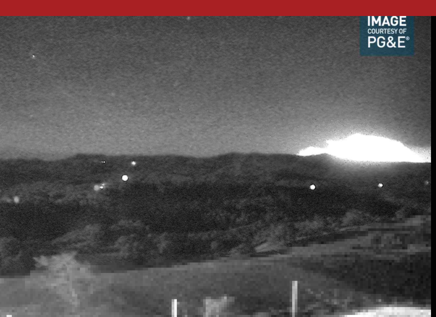
FIRE CAMERAS
PG&E – Tehama Carmel 1 – https://www.alertwildfire.org/tile-display/viewer/?cams=Axis-TehamaCarmel1&fbclid=IwAR0KVuwmLCZYusvqomJeYesg6QUJTlfdSfxwfyNFRVx8_mh7OAG8BQcpaYA
INCIDENT COOPERATORS | IMPORTANT MESSAGING
City of Monterey
Monterey County Information
2310: A Red Cross evacuation shelter will be open at 2330 hours at the Carmel Middle School, 4830 Carmel Valley Road. El Refugio de la Cruz Roja Americana estará disponible a partir de las 11:30 pm en la secundaria Carmel, en el 4380 del Camino Carmel Valley
Monterey County Office of Emergency Services
Monterey County Sheriff’s Office
2130: Mandatory evacuation orders issued for all areas West of 3800 Palo Colorado Rd to Hwy 1 and south to Bixby Creek. These are mandatory evacuations. Link: https://member.everbridge.net/453003085611217/notif/xGGGG8qIG
Caltrans District 5
2200: Closed Road – Hwy 1 at Rio Road in Carmel.
Big Sur FD and Mid Coast FD: Volunteer FFs are on working on the fire ground.
NWS Bay Area
CHP
ESTIMATED SIZE
75-100 acres. 0% containment.
INCIDENT TIMELINE
1926-1934: Fire is burning near Bixby Bridge side, later reported as east of the bridge.
1937: reported as 2-3 acres with heavy wind and no structure threats.
2014: additional CHP resources being paged.
2024: Fire reported as starting in the area of Rocky Creek, Palo Colorado.
2024-2115: 9-1-1 calls coming in about the fire.
2124: Fire reported as getting near SR1, CHP units are requested to close the highway.
2130: Caltrans closes SR1 at the stoplight, north of Weston Ridge. CHP to stop southbound at the light, just north of Weston Ridge. Having a north unit to turn around all southbound traffic.
2132: At Rock Creek, the fire has jumped SR1 and is now burning on the westbound side. Poor visibility.
2134: All traffic being turned around at St Rio Raod.
2137: Law enforcement trying to get people to leave. Fire is now approaching Old Coast Road. CHP works with Carmel PD in Dispatch to start turning traffic around at Rio Road.
2140: IC Rocky Creek is in Palo Colorado.
2201: Parks close the south end. Evacuations were completed from the Fire Station to SR1.
2203: Road closed northbound SR1.
2204: Per FD: fire approximately 150 acres. Mandatory orders were issued on Palo and all other sides on SR1.
2207: Mandatory evacuations were ordered from the fire station westbound to SR1.
2214: Winds blowing from the southeast.
2215: 2nd fire reported at Boney Dune Road and Pine Flat Road between SR1 and Gate C17 in Santa Cruz. No other details on this.
2222: All areas west of 3800 Palo Colorado Road to Hwy 1 and south to Bixby Creek.
2233: All residents on the west side of the fire station have been evacuated.
SCANNER FEEDS
CAL FIRE BEU – https://www.broadcastify.com/listen/ctid/209
Monterey County Fire Agencies – https://www.broadcastify.com/listen/feed/20102
EYEWITNESS ACCOUNTS
2245: Fire can be seen from Capitola Beach.
2232: One wonders how firefighters will fight this fire as there is no level ground, no roads, aircraft not flying during the night.
2224: Fire started in Palo Colorado Canyon. GOES 17 satellite imagery showing the fire on the radar. Dry northeasterly winds are pushing the fire in a southwest direction towards Hwy 1. (weather news)
2103: Fire heading SW toward Rocky Creek and Bixby, which are under evacuation orders.
(c) 2022 NW Fire Blog
