
Update 2: 1/22/2022, 1030 hours PT
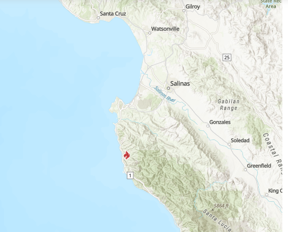
Incident Summary: A structure fire has spread into the wildland interface on 1/21/2022 at 1719 hours PT, approx. 2 miles east of SR1 in Monterey County, CA. CHP units responded to a “Report of a Fire” call at 1926 hours in the 37800 block of Palo Colorado Rd. This is burning on the edge of the 2016 Soberanes Fire burn scar.
This fire is named the COLORADO FIRE but is also being called BIG SUR FIRE, COLORADO IC according to Social Media.
Current Status: 1,500 acres with a 5% containment status.
Fire Behavior Analysis: Active behavior overnight. Photos on Social Media indicate pretty surreal fire behavior given the wet October and December observed across the region. Per historical fire, data appears the fire is burning south of Palo Colorado and towards Bixby Creek along Long Ridge in an area with little or no fire history. It seems as though the recent rains and cold winter weather aren’t helping to keep fires from developing. It appears the fire started last evening during peak offshore winds and a very low RH. The strongest winds have ended in the vicinity of the Colorado Fire. As of 0300 hours on Saturday, the current weather is showing RH values of 42-52% with southerly winds around 5 mph. These light south winds will represent a possible change for residents and firefighters should be aware of today. (NWS Bay Area via https://twitter.com/NWSBayArea)
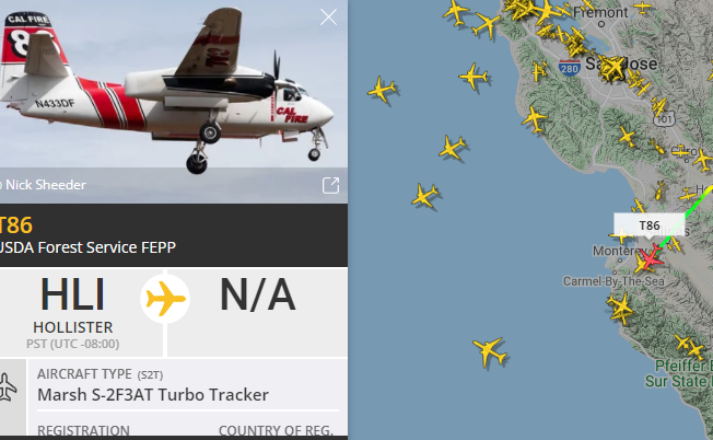
Resources: CAL Fire T73 (USDA FS FEPP), T86 (USDA FS FEPP) out of Hollister Tanker Base.
Photo Credit: Flight Radar 24 Flight Tracker

Evacuations: Mandatory evacuations for all areas west of 3800 Palo Colorado Rd to Hwy1 and south to Bixby Creek were issued by Monterey Fire Officials.
Monterey County has an evacuation map found at this link: https://montereyco.maps.arcgis.com/apps/webappviewer/index.html?id=905a9458324b4868804d96b5593eb978&fbclid=IwAR2-4jxWX4
Shelters: Red Cross Shelter at the Carmel Middle School, 4380 Carmel Valley Rd, Carmel, CA 93923. The SPCA Monterey County is also onsite with an Animal Support Trailer and personnel to co-shelter.
Emergency Alerts: Receive Monterey County fire info text alerts. Text MCWILDFIRE to 888777.
Road Closures: Hwy 1 from Molera Park Entrance. From Coast Road to Granite Canyon Bridge per Caltrans. No estimated ETA is known.
Mapping: The fire location can be found here on this CAL Fire map.
Fire Images/Videos:
CAL Fire: Unified Command San Benito-Monterey unit with Mid Coast FD.
(c) 2022 NW Fire Blog
